
Farmers Get Tools from Space
Subheadline
Service combines data from NASA sensors in orbit to determine current field conditions
Professor and scientist Wim Bastiaanssen founded Dutch company IrriWatch BV in 2019 because he wanted to put a powerful, space-based tool into the hands of farmers – one that would help them make better-informed decisions about their day-to-day operations. This means the tool, unlike many others based on satellite data, offers frequent, up-to-date information that can help farmers save crops before the point of no return.
“If you tell them what happened in their field 10 days ago, that’s too late,” said IrriWatch product manager Roula Bachour. “You don’t need to tell me I have dry soil if I already see the crop is dead.”
As NASA has continued to place more eyes in the sky and has made the resulting data troves freely available, a number of companies have sprung up to turn that information into tools for farming. But these have typically informed long-term decision-making, like adjusting farming practices from one season to the next or anticipating harvests well in advance. Bastiaanssen wanted to help farmers plan each day based on conditions in their fields at the moment.
IrriWatch is also one of the only products to combine that timeliness with the ability to use satellite data to calculate evapotranspiration – the amount of water that’s evaporating from soil or being “exhaled” by crops, which is an excellent indicator of the plants’ health. This information is derived from thermal imagers on satellites by applying sophisticated mathematical algorithms. There are a handful of such models, one of which Bastiaanssen created in the 1990s, and Bachour said these detailed models of energy balance are tricky enough that most companies prefer simpler methods.
While models for observing plant health based on data from visible and near-infrared wavelengths, such as the normalized difference vegetation index, are more widely used, they often don’t register plant stress until it’s too late, she said.
In June of 2023, the company, whose offices remain in Wageningen, Netherlands, merged with the Luxembourgish company Hydrosat, which also provides thermal satellite imagery and is launching its own constellation of small satellites to supplement existing Earth-imagers, ensuring frequent, high-resolution imagery all over the globe. IrriWatch will retain its name as a product of Hydrosat.
Watching for Wilting
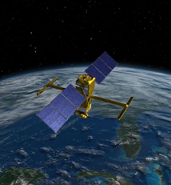
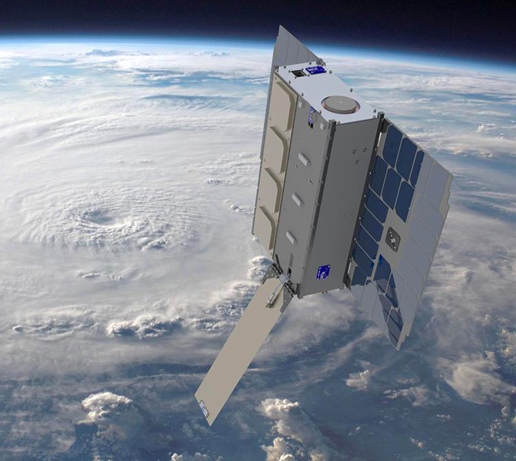
For now, IrriWatch pulls its thermal data from three sources. One, the Ecosystem Spaceborne Thermal Radiometer Experiment (ECOSTRESS), is the first Earth-imager developed specifically to look at evapotranspiration. Built at NASA’s Jet Propulsion Laboratory in Southern California, ECOSTRESS sits on the outside of the International Space Station, where it was affixed in 2018. Meanwhile, a series of Landsat satellites, built and launched by NASA and managed by the U.S. Geological Survey, have been observing Earth’s surface for 50 years and form the workhorse by which most other Earth-observing satellites are calibrated. And the Visible Infrared Imaging Radiometer Suite (VIIRS) comes from a partnership between NASA and the National Oceanic and Atmospheric Administration.
ECOSTRESS boasts more thermal bands than Landsat and much higher resolution than VIIRS. But its home on the space station gives it another advantage, said Simon Hook, principal investigator for ECOSTRESS at JPL. While most Earth-observing satellites are in Sun-synchronous orbit, meaning they always pass over the same places at the same time of day, the space station’s orbit puts it over a given spot at all different times of day. “We know plant stress is changing throughout the day, so by flying over at different times of day, we can look at this pattern, whereas the other satellites can’t,” said Hook.
Because evapotranspiration shows how much water a crop is consuming and the models can tell how wet the soil is, it helps a farmer gauge irrigation needs from day to day and get the most crops for the least water, hence the name IrriWatch. But more information can be extrapolated from that data, Bachour said. This includes the production of dry matter, which helps predict yields, as well as the amount of water a field is using over time, which helps with water management. It is also used to calculate how much carbon is being sequestered in the soil, which could validate environmentally friendly farming practices. And by simply showing plant stress, it can alert farmers to diseases, pests, and other problems.
Bachour said she’s also heard of benefits from subscribers who were able to significantly cut back diesel consumption by pumping less water or planned their harvest based on daily dry matter production, or who saved time by visiting only fields where the data showed problems arising.
But not all subscribers are farmers. Water managers from California to India use IrriWatch to calculate water use more accurately and allocate water more fairly. The service helps companies that breed plant seed varieties in a couple of ways. It can help them directly monitor and compare the performance of their plant varieties in different parts of the world. And because these are often grown by contractors, the seed company may want to supply its contract farmers with IrriWatch data to help them farm and ensure consistent practices. Bachour noted that food processing companies also use it to monitor their suppliers’ farms to predict how much yield to expect and which farms should be harvested first. Still other subscribers are companies with their own digital agriculture platforms and apps, who incorporate IrriWatch data into their products.
Everything Everywhere Every Day
By the time of its merger, IrriWatch, an eight-person operation, had customers in about 60 countries.
Bachour noted that the entire business model has been based on high-quality NASA data that is accurate, constantly updated, and – crucially – freely available. “You can only make it available for farmers if it’s affordable, and it’s affordable because we get the data for free,” she said. “They don’t want to pay more than the water savings or whatever else they’re gaining.”
If she could ask for anything more, she said, it would be more of that data: “I wish we had a Landsat image every day all over the world.” It’s a wish that may soon be granted, not by Landsat but by combining new instruments from NASA and other space agencies, as well as the coming Hydrosat constellation.
For its part, NASA’s ECOSTRESS is a precursor to a planned Surface Biology and Geology mission that will expand its work, said Hook. “So these measurements will hopefully be available for farmers for many years to come.”
Looking ahead, he said, the French and Indian space agencies are proposing to develop another, similar instrument, as is the European Space Agency. By combining these with ECOSTRESS’s successors, said Hook, “we’ll get these detailed temperature measurements of the entire Earth every day, and that would just be absolutely fantastic for science and for societal benefit.”
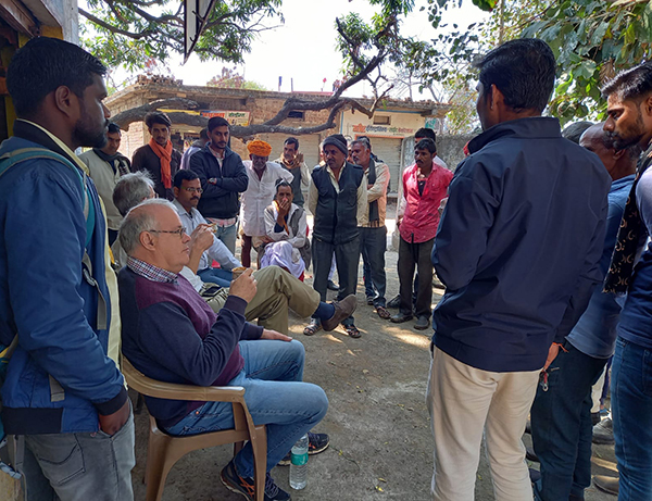
In February of 2023, IrriWatch founder and CEO Wim Bastiaanssen meets with farmers in the Indian state of Madhya Pradesh, who are using IrriWatch to schedule irrigation more efficiently for a variety of crops. Credit: IrriWatch BV
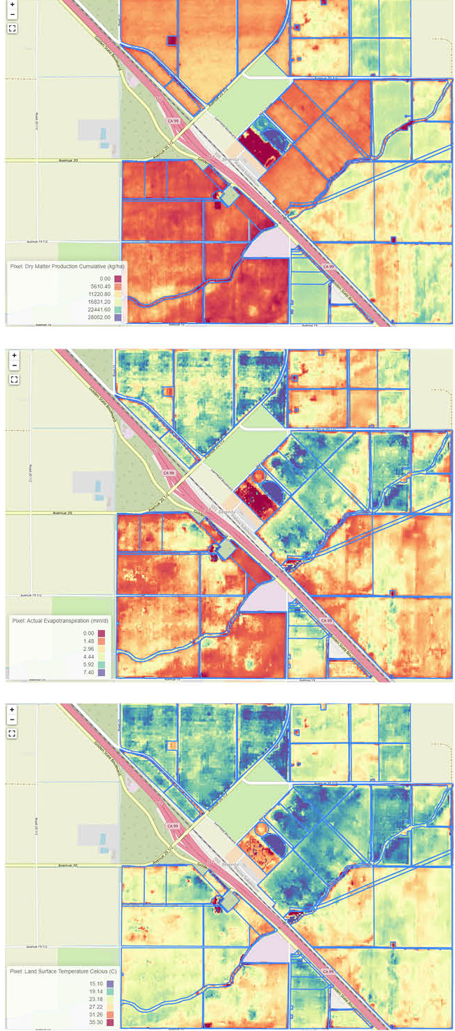
Screenshots from IrriWatch’s portal show different aspects of fields in Madera County, California, where the local Groundwater Sustainability Agency uses IrriWatch to monitor water used for irrigation. From top to bottom, the images, acquired in May of 2023, show dry matter production, evapotranspiration, and surface temperatures. Credit: IrriWatch BV
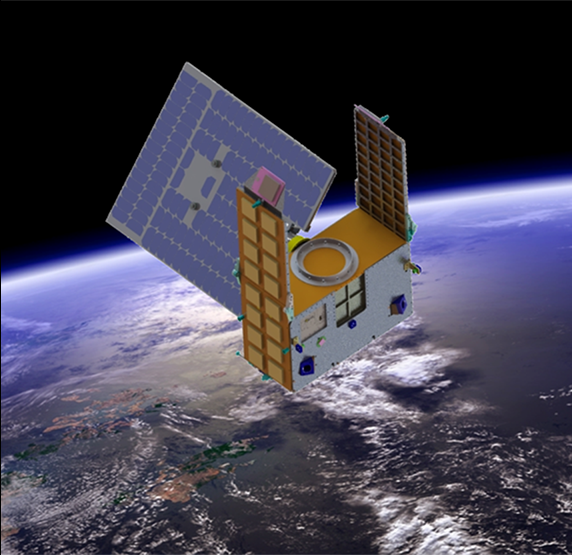
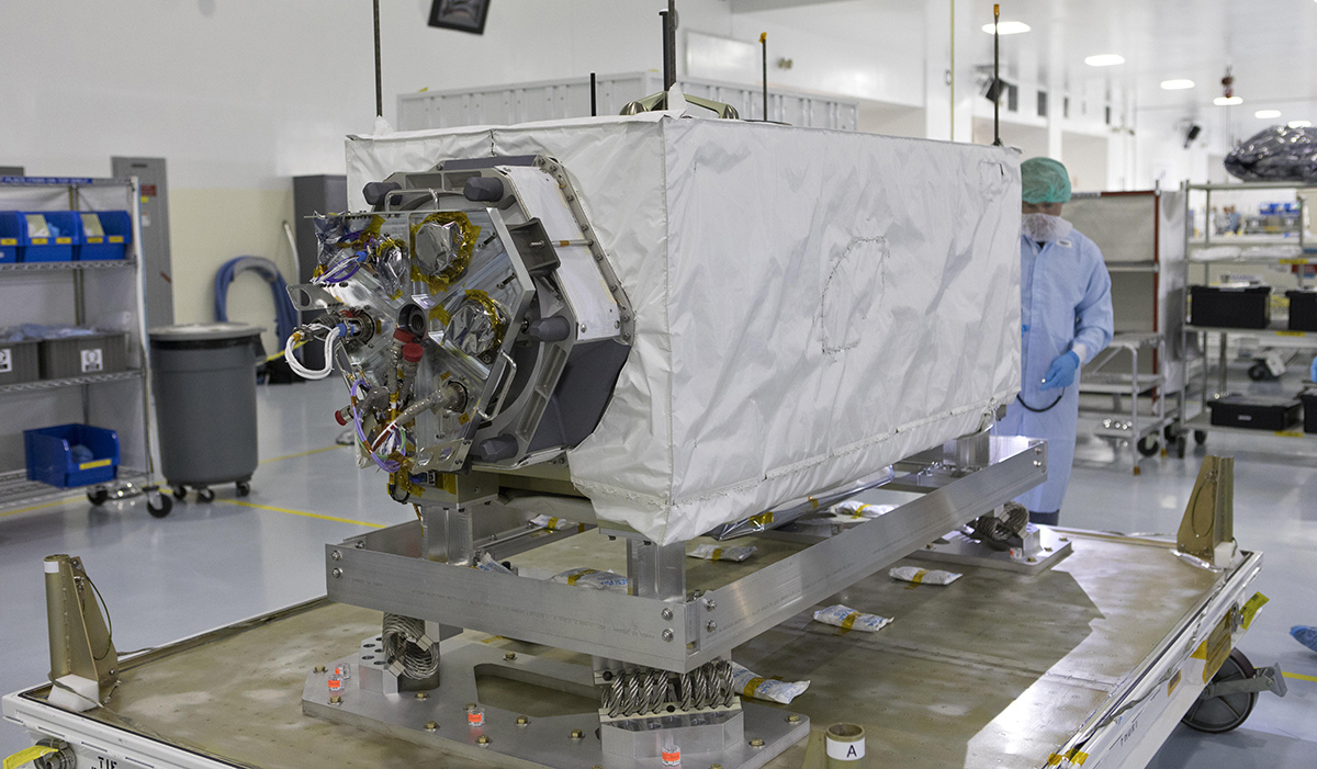
One of IrriWatch’s sources of data is the Ecosystem Spaceborne Thermal Radiometer Experiment (ECOSTRESS), seen here undergoing inspection at Kennedy Space Center prior to launch. Built at the Jet Propulsion Laboratory and affixed to the outside of the International Space Station since 2018, ECOSTRESS is the first Earth-imager developed specifically to look at evapotranspiration, a major indicator of plant stress. Credit: NASA