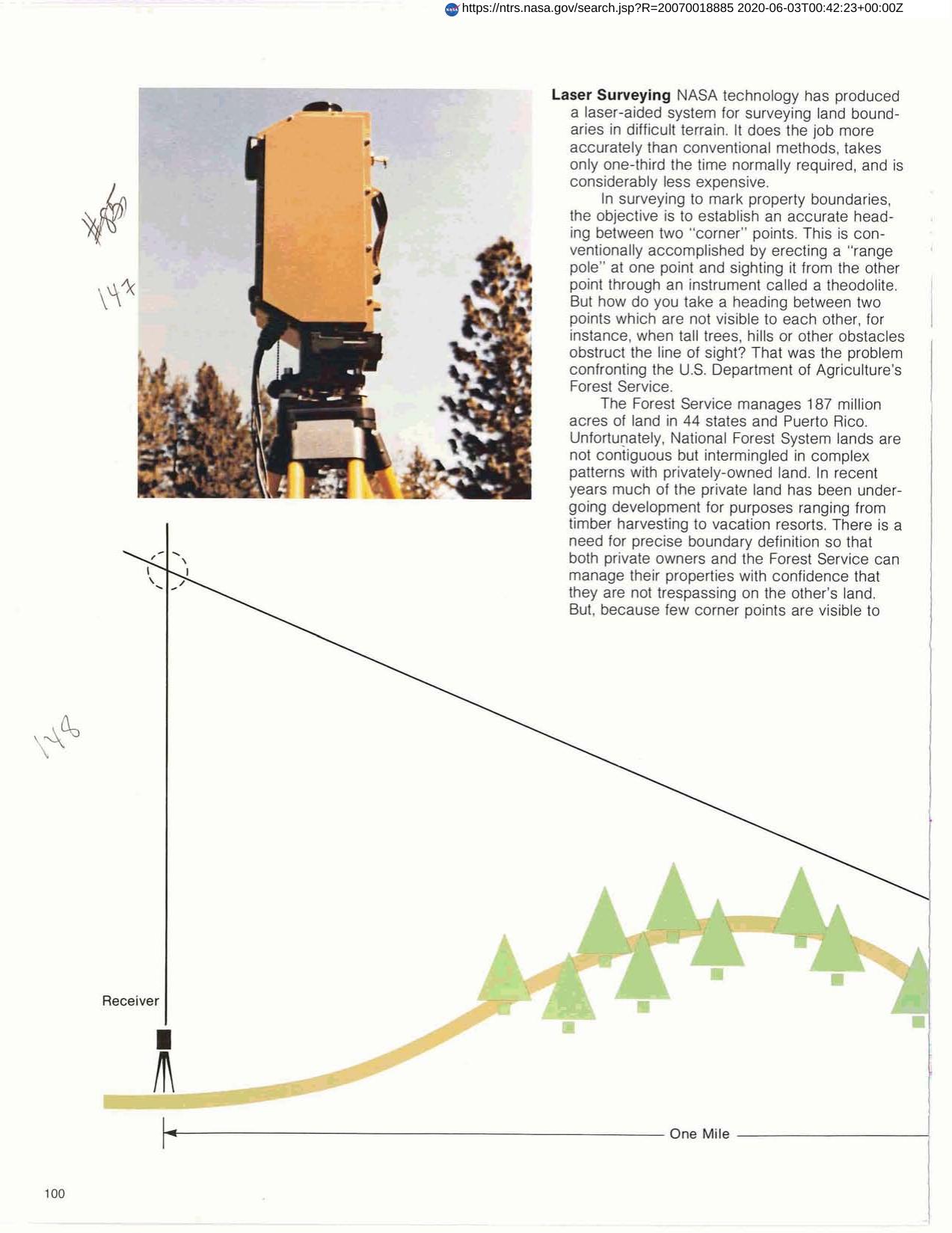

Laser Surveying
RCA Automated Systems Division incorporated NASA technology into the production of a laser-aided system for surveying land boundaries in difficult terrain. System is called Laser Range Pole" consisting of a laser transmitter and a receiver/theodolite which weighs a combined 58 pounds and can be backpacked into rugged country. Tripod mounted transmitter sends vertical column of light straight upward from a corner marker. Theodolite operator makes fine adjustments to sighting equipment until indicator light tells him his optical sight is correctly aligned with laser beam. This establishes precise heading between the two boundary markers allowing crews to set stakes along the heading by conventional line of sight methods."
Full article: http://hdl.handle.net/hdl:2060/20070018885
Laser Surveying
Laser Surveying