
Geography From Another Dimension
It used to be that teachers would begin a lesson by asking students to open their textbooks. However, in this day and age, textbooks are starting to take a back seat to computer technology at numerous school systems throughout the United States.
With young students becoming more acclimated to personal computers, teachers now have the luxury of utilizing various software programs and applications to provide real-time learning. This alternative approach to education has made the classroom a more enjoyable atmosphere for students of all ages.
To further emphasize the important balance between computer literacy and education, Berkeley Geo-Research Group (BGRG) created a state-of-the-art program called GEODESY that helps students in middle and high schools develop proactive problem-solving skills to answer questions about where they are, why they are there, and how they can improve the quality of life in their community, and ultimately, in their world. Back in 1994, Orinda, California-based BGRG began developing GEODESY with technical assistance and financial support from Stennis Space Center's Commercial Remote Sensing Program Office, now known as the Earth Science Applications Directorate. In addition, BGRG received an award from NASA's Earth Observations Commercial Applications Program, which co-funded the project in its early development stages.
GEODESY is intended to promote geographical awareness among students with its remote sensing capabilities to observe the Earth's surface from distant vantage points. Students and teachers using the program learn to interpret and analyze geographical data pertaining to the physical attributes of their community. For example, the program provides a digital environment of physical features, such as mountains and bodies of water, as well as man-made features, such as roads and parks, using aerial photography, satellite imagery, and geographic information systems (GIS) data in accordance with National Geography Standards.
The GEODESY technology is divided into four "core tracks," each building upon the other and introducing the student to a critical component of digital GIS use and analysis. The first core track acquaints students with the tools that are being used to study the environment. Students start off by studying a plan view of their local school area as seen in an aerial photograph. They are then introduced to the concepts of vector-based mapping using point, line, and polygon with respect to landscape features, including their school, roads, forested areas, and other local items that are identified in the aerial photograph.
The next step for the students is to evaluate satellite images for recognizable features, using GEODESY's raster-based image viewing and processing technology. This functionality allows both students and teachers to interact with an image beyond its basic visual interpretation.
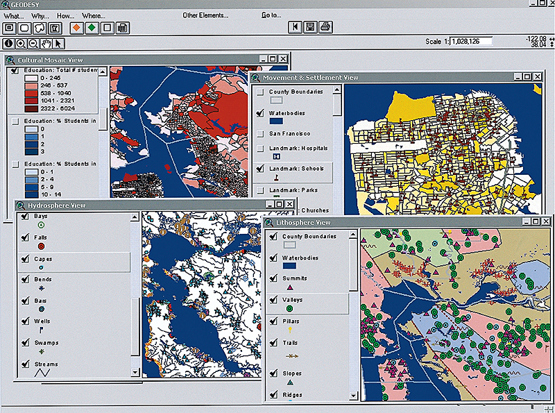
Students and teachers are now ready to use all of the tools they have learned thus far to study physical and human elements in their local community. The physical elements include atmosphere, biosphere, hydrosphere, and lithosphere, while the human elements are movement and settlement (the interaction between people and places), cultural mosaic (age, ethnicity, education), economic activities (housing values, employment statistics, per capita and median income levels), and political divisions (county and city boundaries, voting districts). Once students and teachers become more familiarized with the digital geography of their local surroundings, they can manipulate and overlay combinations of physical and human features to identify if a spatial relationship exists between them, and to evaluate whether such a relationship is direct or inverse. The main goal is to have the students, as well as the teachers, gain a better understanding of the unique forces that drive their coexistence.
BGRG has teamed up with Ridgeland, Mississippi-based Digital Quest, Inc., to implement GEODESY at 120 middle and high schools across Mississippi. Digital Quest is a member of the Mississippi Space Commerce Initiative, a consortium whose goal is to develop a remote sensing industry in the state by commercializing the technologies developed by NASA at the Stennis Space Center. BGRG and Digital Quest are expanding beyond the core of GEODESY by assembling a 3-year spatial science curriculum called SPACESTARS. This application, which is already in place at three high schools in Arkansas and Mississippi, will continue to help students answer challenging questions about the factors that contributed to the location of their school, including whether the local community will need more classrooms/schools in 10 years, and if the current bus routes are the most efficient and direct. Both GEODESY and SPACESTARS will be introduced to schools in Texas and Ohio in the 2002-2003 school year.
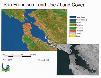
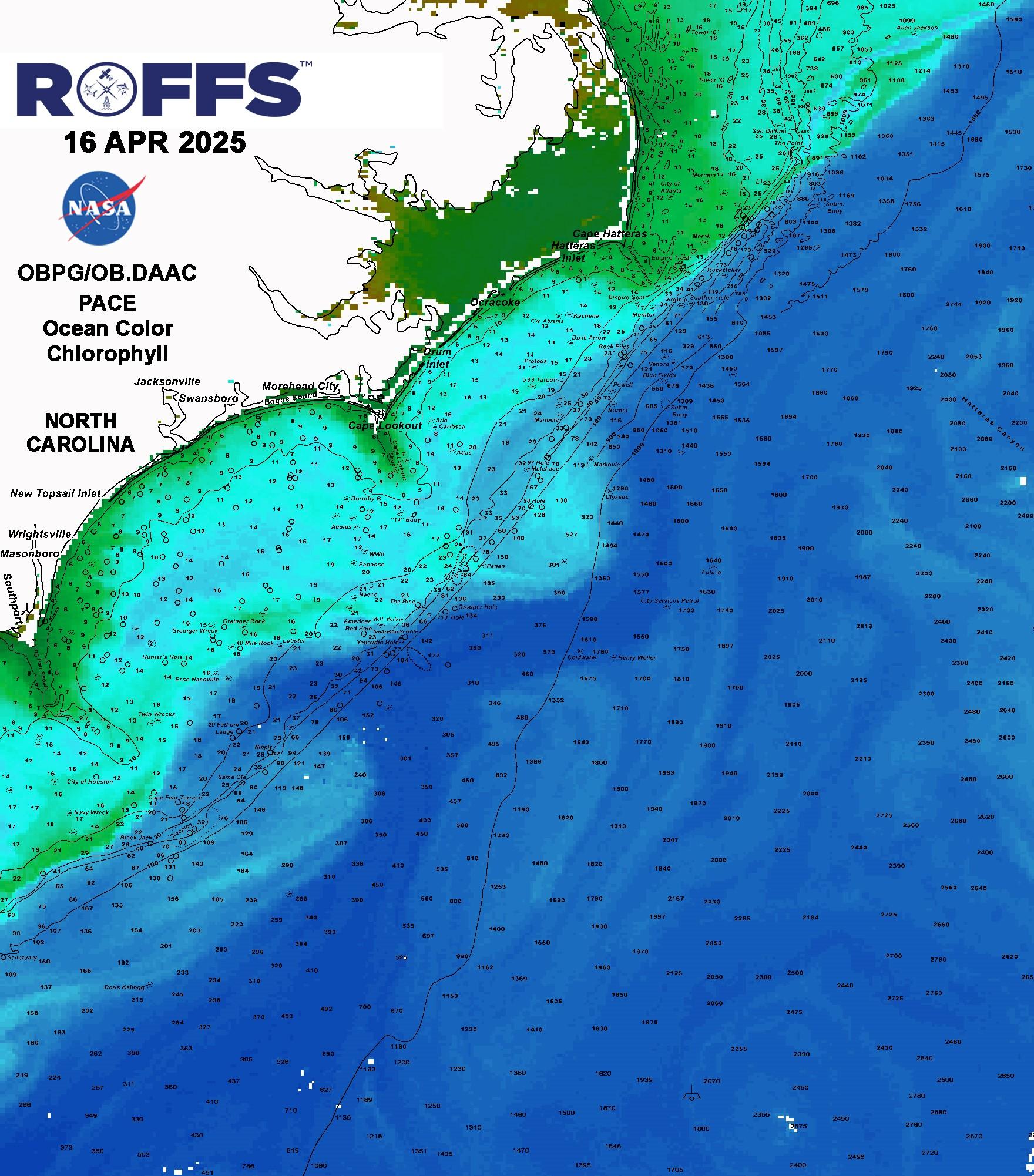
From a satellite image of San Francisco, GEODESY is able to map water depth, terrain, and transportation routes.
GEODESY allows students and teachers to interpret human and physical elements in their local community to gain a better understanding of their surroundings. In this image, such elements are plotted across various regions of the Bay Area.