
A New Definition for Ground Control
Touted as the "best seat in the house" by NASA astronaut Ken Ham, an advanced flight visualization system that simulates conditions of a real flight from a remote location is making way for safer landings. Rapid Imaging Software, Inc.'s LandForm® VisualFlight® blends the power of a geographic information system (GIS) with the speed of a flight simulator to transform a user's desktop computer into a "virtual cockpit."
The software product, which is fully compatible with all Microsoft® Windows® operating systems, provides distributed, real-time three-dimensional (3-D) flight visualization over a host of networks. From a desktop, a user can immediately obtain a cockpit view, a chase-plane view, or an airborne tracker view. A customizable display also allows the user to overlay various flight parameters, including latitude, longitude, altitude, pitch, roll, and heading information. Additionally, LandForm VisualFlight's telepresence technology lets users construct and deploy their own immersive multidimensional display applications on Windows-based platforms.
Rapid Imaging Software created the technology in response to its customers' desires for a version of the already-existing LandForm product that they could integrate with software they wrote themselves. In particular, the customers were seeking a version of LandForm which would let them combine their aircraft and vehicle models, live flightpaths, and heads-up displays with LandForm geographic data servers in three dimensions.
The company sought assistance from NASA, and the VisualFlight technology came to fruition under a Phase II Small Business Innovation Research (SBIR) contract with Johnson Space Center in 1998. Three years later, on December 13, 2001, Ken Ham successfully flew NASA's X-38 spacecraft from a remote, ground-based cockpit using LandForm VisualFlight as part of his primary situation awareness display in a flight test at Edwards Air Force Base, California. This simulated a realistic flying environment and landing for the windowless X-38, which is expected to eventually serve as NASA's Crew Return Vehicle for the International Space Station.
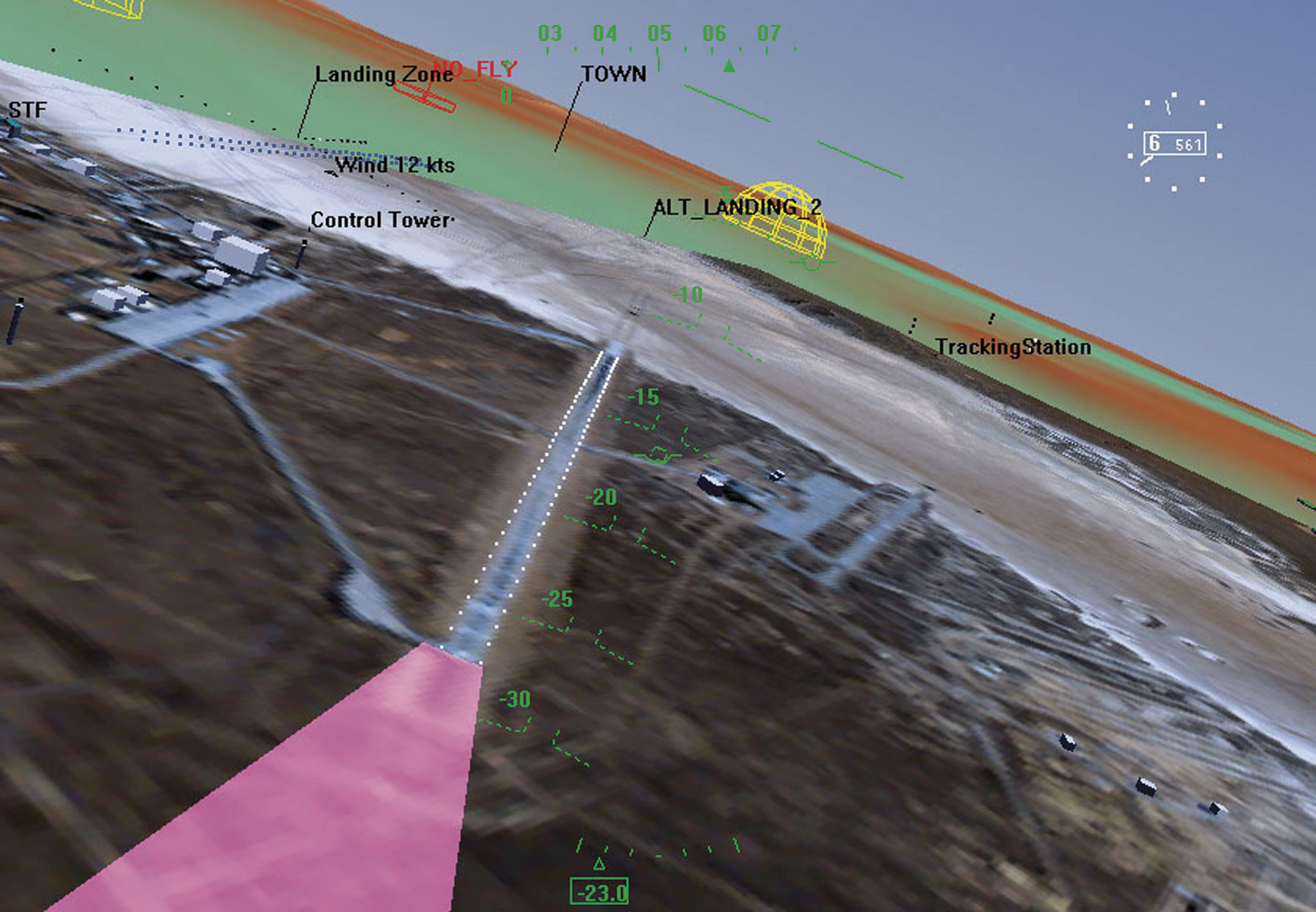
From a remote personal computer, Ham was able to determine the X-38's position and attitude information via transmissions received from an onboard Global Positioning System that provided the correct camera perspective. The remote cockpit utilized a hybrid synthetic vision system that combined live, forward-looking video with computer-generated 3-D topography of the X-38's flight path to touchdown. A terrain database that features topography, satellite imagery maps, and aeronautical charts was also used to synthesize the 3-D view.
The commercial model of LandForm VisualFlight (available to qualified users) is comprised of a LandForm Server control that contains and manages all terrain, image, entity, track, and real-time data; a MapView control that provides a moving map view of all information in the databases; and a LandForm 3-D view control that provides a real-time, 3-D "out-of-the-window" (or chase-plane) view including all elements of the databases.
LandForm VisualFlight is now used for virtual reality training of crews, analysis of flight test data, teleoperation of remotely piloted vehicles, and as an onboard immersive situation awareness display. The flight visualization software assisted a major consulting firm in airport approach planning, and continues to play a significant role as an analysis tool for air safety investigations led by legal firms and air safety experts.
Landform® and VisualFlight® are registered trademarks of Rapid Imaging Software, Inc.
Microsoft® and Windows® are registered trademarks of Microsoft Corporation.
Chase plane view of the X-38 Crew Return Vehicle.
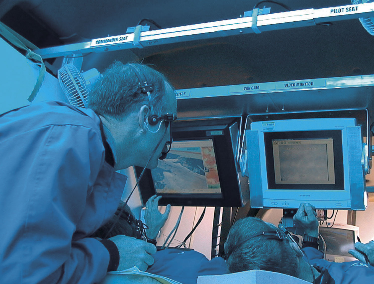
Astronauts in the remote cockpit of the X-38 fly the vehicle using LandForm® VisualFlight® situation awareness displays.
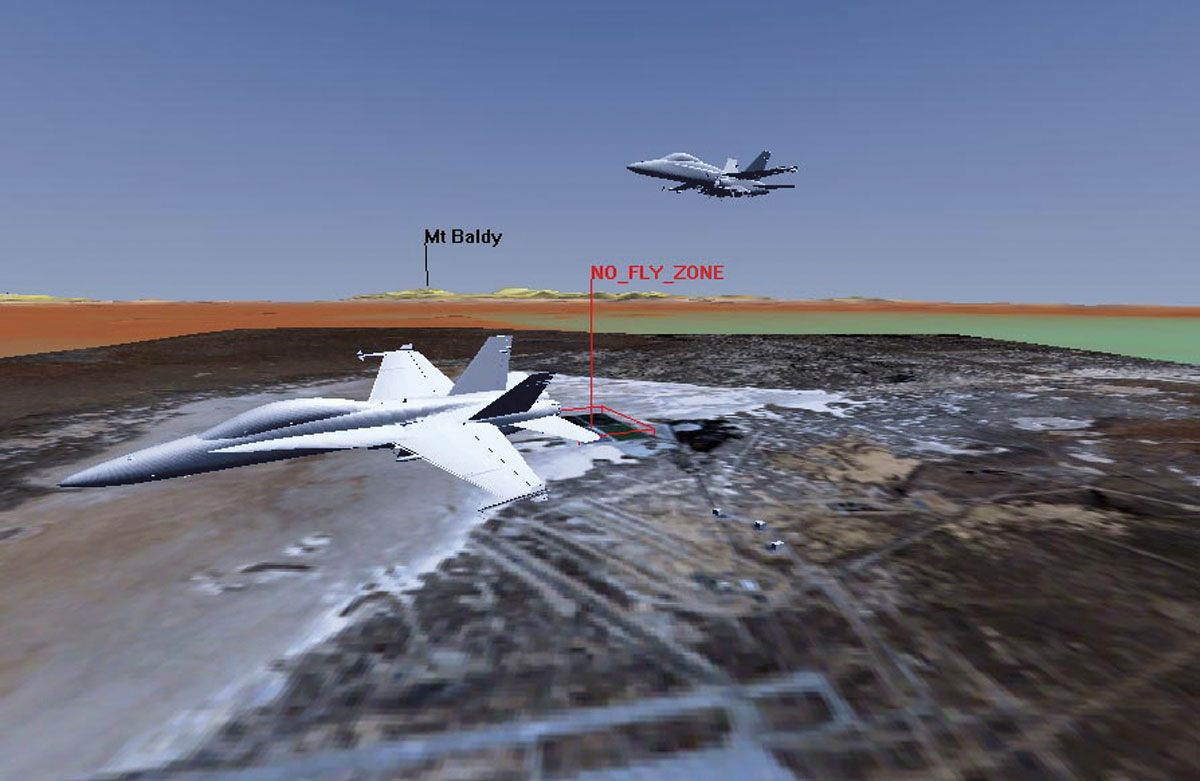
VisualFlight® view also showing other traffic in the area.
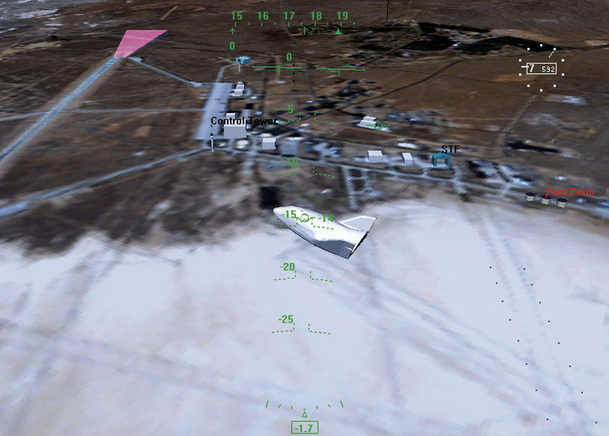
VisualFlight® synthetic vision view out the window at Dryden Flight Research Center.