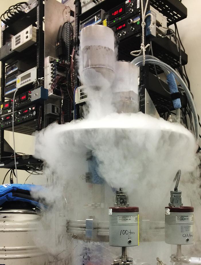
Weather Forecasters Adopt NASA’s ‘Occult’ Science
Subheadline
Radio occultation, pioneered by NASA for other planets, offers cheaper, better Earth weather data
Halfway through 2020, there was almost no aspect of modern life that hadn’t been affected by the COVID-19 pandemic, and weather forecasts were no exception. Weather agencies rely in part on data from atmospheric sensors on commercial aircraft, most of which were grounded. So Vienna, Virginia-based Spire Global Inc. offered weather agencies atmospheric data its constellation of small satellites was collecting by a technique, relatively new to weather forecasters, called radio occultation. The European Centre for Medium-Range Weather Forecasts accepted the offer.
“They assimilated it into their models and found that our radio occultation data was able to make up for the lack of in-situ data from airplanes,” said Vu Nguyen, radio occultation orbit scientist at Spire.
This method of atmospheric sounding wasn’t entirely new to weather scientists, though not much radio occultation data had been available previously. But it was already ancient history to researchers at NASA’s Jet Propulsion Laboratory in Southern California, where the technique was pioneered and first used to gather data on the Martian atmosphere from the Mariner spacecraft in the 1960s.
Only now, however, is the technique poised to improve accuracy and reduce costs of atmospheric modeling for weather forecasts, with further implications for other Earth sciences. Accurate weather prediction helps protect lives, health, and property and has significant benefits for industries such as agriculture, energy, construction, and transportation. Weather and atmospheric data is also foundational to understanding and predicting long-term trends in climate change.
Radio occultation is the observation of changes to a radio signal from a spacecraft as it passes behind a planetary body. As the signal’s path to a distant observer moves closer to the planetary surface, it passes through – or is “occulted” by – the planet’s atmosphere, which bends the signal. The degree of this refraction, as well as other effects on the signal, reveal information about the atmosphere’s temperature, pressure, and moisture.
After sounding the Martian atmosphere, JPL scientists used the technique to characterize the atmospheres of the rest of the solar system’s planets and a few of their moons. But observing Earth with radio occultation would be trickier. For one thing, both the transmitter and receiver have to be off the planet being observed. To take readings from other planets, the receiver could sit on Earth. But to observe our own atmosphere, the receiver would have to be in space, and receivers of the day were large and heavy. A bigger challenge was that, for the data to add to existing knowledge of Earth’s atmosphere, a large number of signals and receivers would be needed.
GPS Guides Radio Occultation Home
By the late 1980s, though, these problems were resolving themselves. Advances in computing power produced smaller receivers, and a multitude of new space-based radio transmitters were being placed in Earth orbit as the U.S. Air Force launched the first GPS satellites. In 1988, JPL scientist Thomas Yunck wrote the first proposal for using GPS signals to gather radio occultation data for Earth weather and climate observations.
The technique offered clear advantages over the technology that still dominates atmospheric observation from space. The signals are not blocked by clouds, and because they pass horizontally through the atmosphere at a series of different altitudes, they can produce more accurate, detailed vertical profiles of the air than any other satellite technology. Because they aren’t subject to drift or bias, they can be used to calibrate other types of sensors. And GPS radio receivers were already smaller and cheaper than the instruments on traditional weather satellites, such as passive infrared and microwave sounders.
Yunck’s proposal caught the attention of researchers at the University Corporation for Atmospheric Research (UCAR), who successfully lobbied their sponsoring organization, the National Science Foundation, to fund a demonstration of the concept. The GPS/MET instrument, adapted by UCAR and partners from an existing JPL receiver, was placed on NASA’s Microlab 1 minisatellite and launched in 1995. JPL helped modify the receiver’s software and analyze the experiment’s results, which, although limited, resoundingly proved the feasibility of the approach.
NASA then sponsored five more demonstrations mounted on satellites already scheduled for launch, testing more capable receivers and laying the groundwork for the first constellation of radio occultation satellites. COSMIC-1 (Constellation Observing System for Meteorology, Ionosphere, and Climate), a group of six small satellites launched in 2006, was funded by the Taiwanese space agency, spearheaded by UCAR, and supported by NASA, the National Oceanic and Atmospheric Administration (NOAA), and others. Over the next 14 years, COSMIC-1 produced millions of atmospheric profiles, and most major weather agencies started working these into their models.
By the time COSMIC-2 launched in 2019, a few companies had already put the first commercial radio occultation satellites into orbit. Although the commercial market for this data was barely emerging, there were clear incentives for companies to enter the field. The advent of CubeSats and other small satellites had helped reduce the cost of putting radio occultation equipment into space to a fraction of the cost
of legacy weather-observation systems.
An Industry Emerges
“With a tiny, $40,000 instrument, you can get results 10 to 20 times more accurate than with traditional instruments costing tens or hundreds of millions of dollars,” said Yunck, who in 2006 founded the company GeoOptics Inc. of Pasadena, California, to advance commercial radio occultation.
GeoOptics’ CICERO (Community Initiative for Cellular Earth Remote Observation) constellation, launched between 2018 and 2022, now comprises four satellites, all equipped with a receiver that JPL engineers modified specifically for the project.
Rob Kursinski, a former colleague of Yunck’s, also worked on radio occultation and other GPS-based projects at JPL for decades before he cofounded PlanetIQ Inc. of Golden, Colorado, in 2015 to commercialize the technology. PlanetIQ started collecting radio occultation data in 2021 after its first satellite failed in orbit a year earlier. The company now has two operational satellites, with plans to expand to a constellation of 20 in the next few years. Kursinski said PlanetIQ will emphasize getting the most out of each of its spacecraft, with a higher number of atmospheric profiles per day reducing the cost per profile, and with a high signal-to-noise ratio enabling readings from the lowest mile or so of the atmosphere, which has proven challenging with radio occultation.
Spire currently has by far the most radio occultation satellites in orbit, with about 40 of its 100-plus Low Earth Multi-Use Receiver (LEMUR) satellites using the technique to collect atmospheric data. Nguyen, radio occultation scientist with the company, noted that the data, while inexpensive to acquire, can have an outsized impact on the accuracy of weather forecasts, especially when it’s gathered from areas where there’s a shortage of information from other sources, like over oceans where weather balloons are scarce.
Spire is now the first vendor to sell radio occultation data to NASA. Through the agency’s Commercial Smallsat Data Acquisition program, NASA first validated the company’s data and now purchases it and makes it available to authorized researchers.
All three companies are expanding capabilities to use signals not only from the United States’ GPS constellation but also from the European, Russian, and Chinese global navigation satellite systems (GNSS), multiplying the number of atmospheric soundings a given satellite can make.
NOAA started purchasing commercial radio occultation data in 2021, from Spire and GeoOptics, and doubled its order in 2022. Both companies also sell the data to the European Organization for the Exploitation of Meteorological Satellites. And GeoOptics picked up an early commercial customer with the new weather services start-up Climavision.
While the market for selling weather data to private customers remains “embryonic,” Yunck said, a few commercial weather services are emerging and purchasing raw data, while companies like his are developing the ability to turn their own data into informational products for sale to many industries. “A third of the world’s industry uses weather data,” he said. “They want to know what’s going to happen next week, next month – how the climate’s going to change in the next 10 years.”
Divining the Future of Occultation Arts
Today, radio occultation still accounts for just a sliver of the data most weather agencies use, but Kursinski said he expects it to become the dominant source of weather data before long. Even a handful of the soundings can dramatically improve forecast accuracy because they provide precise information with high vertical resolution on temperature, pressure, and water vapor, in clear and cloudy conditions, well beyond other space-based methods, he said. “You can also use that to correct biases in other observations and reduce the uncertainty you assign to that data, which makes everyone else’s data more accurate and useful.”
“The impact on weather forecasting is astonishing,” said Yunck. “When radio occultation is available in large numbers, it will raise forecasting accuracy to new levels.” He noted that this will include long-term predictions of climate change. “It’s a vital new addition to a growing armada of space observatories rapidly improving our understanding of the planet. That’s why I got into it.”
All the companies also noted that radio occultation will improve climate studies because it’s the easiest way to collect accurate temperature readings from the upper atmosphere.
Additional possibilities for Earth science stem from the fact that the same receivers on the same satellites can use GNSS signals for more than just radio occultation. All three companies are working on using techniques that NASA helped pioneer to analyze satellite navigation signals reflected from Earth’s surface for applications like determining soil moisture and wind speeds over oceans. Spire is using the reflected signals to map sea ice, while GeoOptics is mapping the planet’s gravity field with the help of GNSS signals.
The companies also use the same equipment to map activity in the planet’s ionosphere, where electrons affect and can interfere with communications and navigation, selling this data to the Air Force and others.
Another longtime colleague of Yunck and Kursinski’s who is still at JPL, Thomas Meehan, a flight software engineer, said NASA is now working to use radio occultation to detect and analyze heavy rainfall, especially over oceans, where data is sparse, and to improve understanding of the lower atmosphere.
Meehan pointed out that JPL’s work over the last 40 years, building the highly accurate receivers and complex positioning software that let satellites and ground stations process and correct navigation signals, laid the foundation for all this work and more. “What NASA did was take a complex system and put the pieces in place to let science happen at a very low cost, without always knowing what we were solving,” Meehan said. “It was all for potential applications, and NASA understood that. To me, it’s just a massive success story.”

Having used radio occultation to profile the atmospheres of the rest of the solar system’s planets, NASA now plans to use the technique to detect and analyze heavy rainfall on Earth, especially over oceans, where data is sparse. Credit: Getty Images
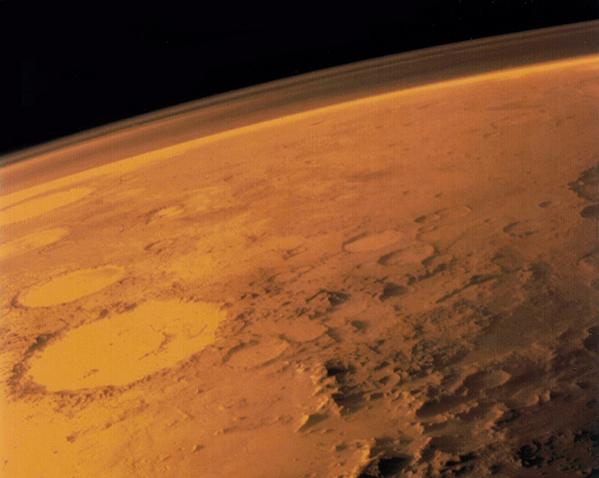
NASA’s Jet Propulsion Laboratory pioneered radio occultation in the 1960s, with the help of Stanford University, to gain the first information about Mars’ thin atmosphere by analyzing signals from the Mariner IV space probe after they had passed through the Martian air. Credit: NASA
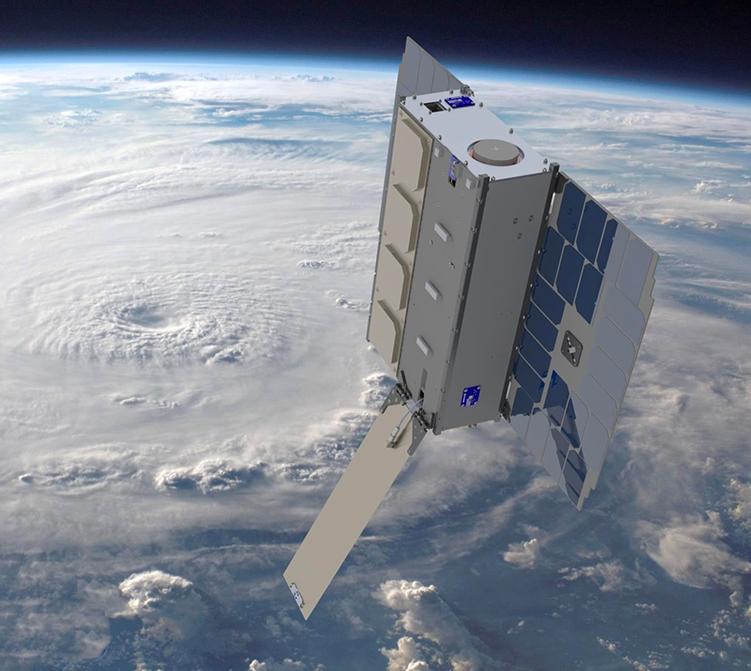
One of GeoOptics’ CICERO (Community Initiative for Cellular Earth Remote Observation) satellites is depicted in low-Earth orbit. Advantages of radio occultation include an ability to see through clouds and high vertical resolution, meaning it can distinguish the altitudes of phenomena it observes. Credit: GeoOptics Inc.
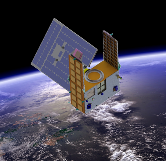
PlanetIQ’s radio occultation satellites are aimed at maximizing signal-to-noise ratios, as well as the number of atmospheric profiles they can gather per day. Credit: PlanetIQ Inc.
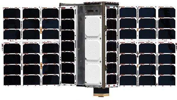
Spire Global currently has the most radio occultation satellites in orbit, having outfitted 40 of its Low Earth Multi-Use Receiver (LEMUR) satellites with radio receivers capable of the technique. Credit: Spire Global Inc.


