

Earth Science Goes E-Commerce
Curiosity and concern about the well-being of our planet has spurred the establishment of NASA's Earth Science Information Partners (ESIP) Federation, an organization that is dedicated to finding new ways of distributing earth science information to both the public and private sectors. The ESIP Federation stems from NASA's Earth Science Enterprise (ESE), which is charged with advancing the understanding of the total Earth system, including the effects of natural or human-induced changes in the global environment.
Among the many partners within the ESIP Federation is the Department of Forest Resources at the University of Minnesota-St. Paul. Researchers there, in collaboration with a number of natural resource management organizations, including the Minnesota Department of Natural Resources, are developing software that increases public access to Earth science information via the Internet. These software packages, in turn, are being commercially marketed by Agri ImaGIS of North Dakota.
Satellite imagery can be a valuable tool in precision farming, also known as "site-specific" or "prescription" farming. Satellite images, for
example, can be used to map highly variable patterns of productivity within a given farm field. These patterns are based on spatial variations in soil characteristics, elevation, average yield, and other factors. Once mapped, these different patterns can be used to establish "management units" for carrying out precision farming techniques, such as variable-rate applications of fertilizer. Precision farming is economically attractive because it allows farmers to add fertilizer, pesticides, or other chemicals only to areas needing treatment, and only in necessary amounts, providing significant savings and increased yields. In addition, precision farming has important environmental benefits: it prevents excess applications of farm chemicals that run off and pollute neighboring streams and other sources of water.
Agri ImaGIS, a company that provides satellite images of farmland and agricultural views to clients throughout the United States, approached NASA-MSU TechLink in Bozeman, Montana, for access to technology that would improve the company's capabilities to deliver satellite images over the Internet. In addition, the company wanted to develop the ability to provide digital cartographic, or geographic information systems (GIS), data over the Internet, including maps of road networks, topography, soil classification, and agricultural yields.
TechLink learned that software with the desired functions had been developed through NASA's Remote Sensing Database Program.
Agri ImaGIS has formed a partnership with the University of Minnesota group, allowing the company to adapt and further develop the software to meet its Internet commerce needs. The company is helping to bring a new dimension to land and farm management, providing cultivators the opportunity to use their land more practically, economically, and with more emphasis on the environmental impact of farming.
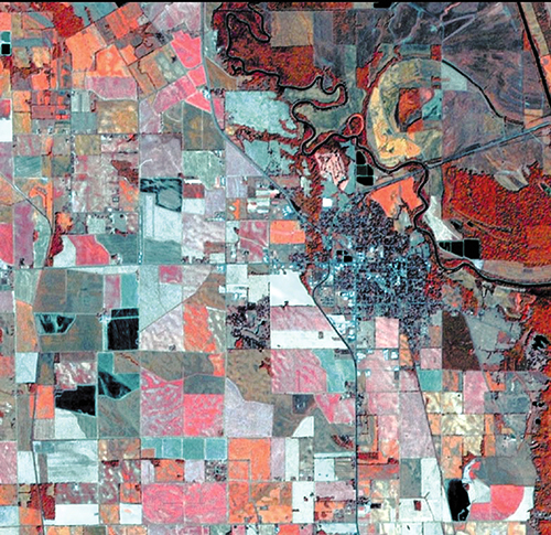
Images like this section of Arkansas are provided to Agri ImaGIS' customers for analyzing farm fields.


