

Archeological/Environmental Research
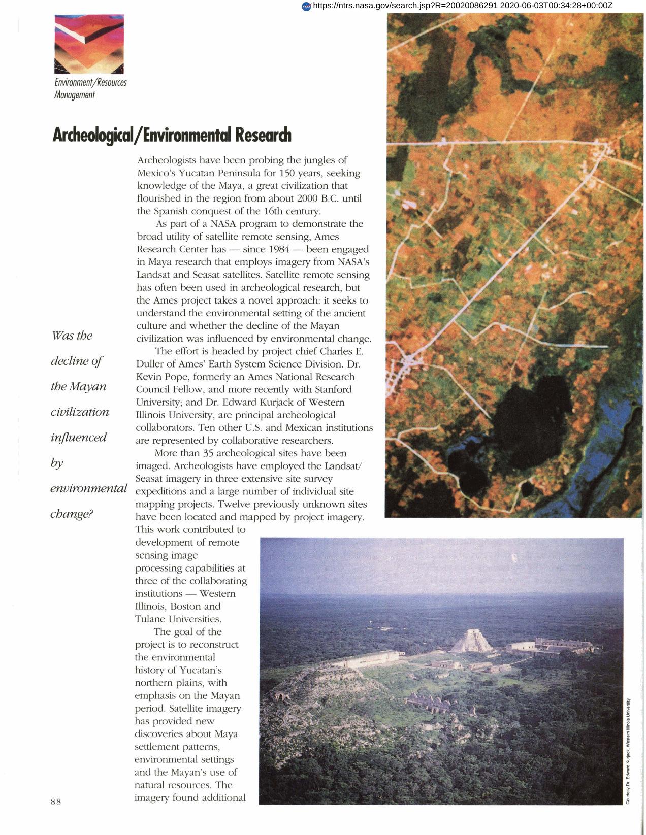
Landsat/Seasat remote sensing was used by Ames Research Center to evaluate environmental influence on ancient Mayan civilization. Over 35 archeological sites were imaged and valuable information concerning Maya settlement patterns, environment, and resource usage resulted. The imagery was also used by Mexican authorities to develop coastal management plans, establish Biosphere Reserves and assess damage from the 1988 Hurricane Gilbert. Imagery showed evidence of ancient coastlines, changes in sea level, an ancient river plain and Mayan canal systems. Previously unknown Mayan reservoirs were discovered. The project is considered a pioneering effort combining remote sensing, environmental studies and archeology.
Full article: http://hdl.handle.net/hdl:2060/20020086291
Archeological/Environmental Research
Archeological/Environmental Research


