

Image Processing
Originally published in 1991
Body
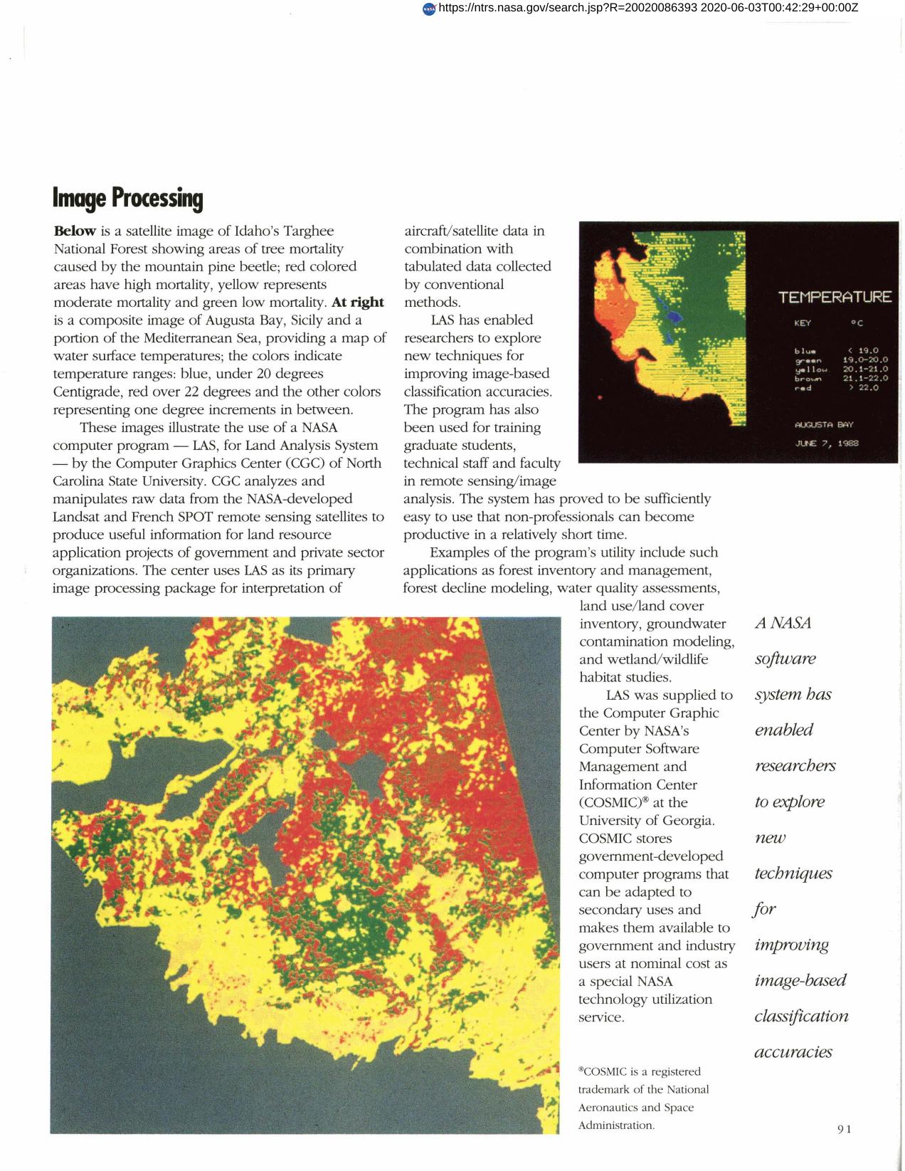
The Computer Graphics Center of North Carolina State University uses LAS, a COSMIC program, to analyze and manipulate data from Landsat and SPOT providing information for government and commercial land resource application projects. LAS is used to interpret aircraft/satellite data and enables researchers to improve image-based classification accuracies. The system is easy to use and has proven to be a valuable remote sensing training tool.
Full article: http://hdl.handle.net/hdl:2060/20020086393
Abstract
The Computer Graphics Center of North Carolina State University uses LAS, a COSMIC program, to analyze and manipulate data from Landsat and SPOT providing information for government and commercial land resource application projects. LAS is used to interpret aircraft/satellite data and enables researchers to improve image-based classification accuracies. The system is easy to use and has proven to be a valuable remote sensing training tool.
Image Processing
Image Processing


