

Forest Imaging
Originally published in 1992
Body
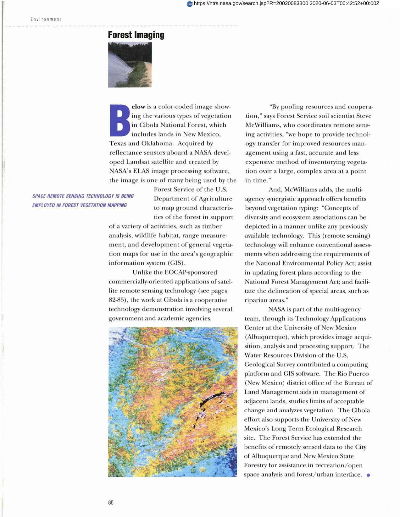
NASA's Technology Applications Center, with other government and academic agencies, provided technology for improved resources management to the Cibola National Forest. Landsat satellite images enabled vegetation over a large area to be classified for purposes of timber analysis, wildlife habitat, range measurement and development of general vegetation maps.
Full article: http://hdl.handle.net/hdl:2060/20020083300
Abstract
NASA's Technology Applications Center, with other government and academic agencies, provided technology for improved resources management to the Cibola National Forest. Landsat satellite images enabled vegetation over a large area to be classified for purposes of timber analysis, wildlife habitat, range measurement and development of general vegetation maps.
Forest Imaging
Forest Imaging


