

The Use of Urban Land
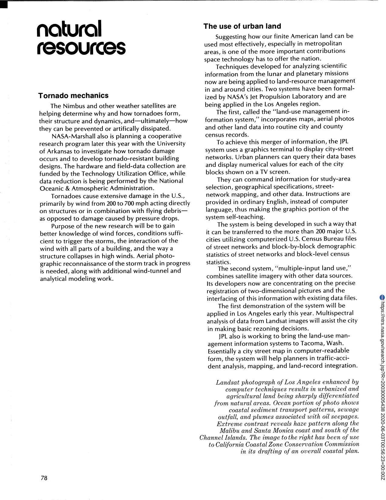
Techniques for analyzing scientific information from the lunar and planetary missions now are being applied to land-resource management in and around cities. Two systems have been formalized by Jet Propulsion Laboratory and are being applied in the Los Angeles area. First called Land Use Management Information System" incorporates maps aerial photos and other land data into routine city and county census records. The second system "multiple-input land use" combines satellite imagery with other data sources. Essentially a city street map in computer readable form the system will help planners in traffic accident analysis mapping and land-record."
Full article: http://hdl.handle.net/hdl:2060/20030005438
The Use of Urban Land
The Use of Urban Land


