

Oil Exploration Mapping
Originally published in 1994
Body
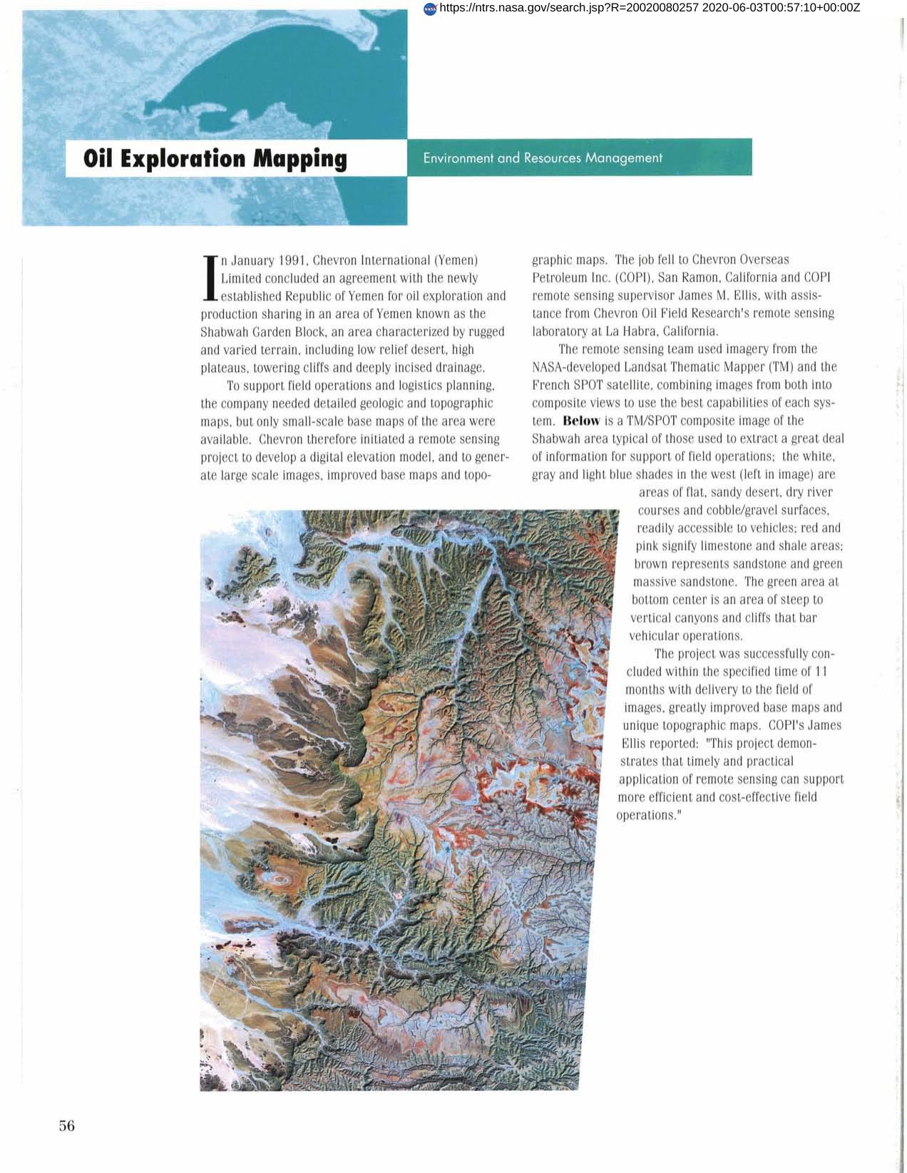
After concluding an oil exploration agreement with the Republic of Yemen, Chevron International needed detailed geologic and topographic maps of the area. Chevron's remote sensing team used imagery from Landsat and SPOT, combining images into composite views. The project was successfully concluded and resulted in greatly improved base maps and unique topographic maps.
Full article: http://hdl.handle.net/hdl:2060/20020080257
Abstract
After concluding an oil exploration agreement with the Republic of Yemen, Chevron International needed detailed geologic and topographic maps of the area. Chevron's remote sensing team used imagery from Landsat and SPOT, combining images into composite views. The project was successfully concluded and resulted in greatly improved base maps and unique topographic maps.
Oil Exploration Mapping
Oil Exploration Mapping


