

Soil Surveys
Originally published in 1985
Body
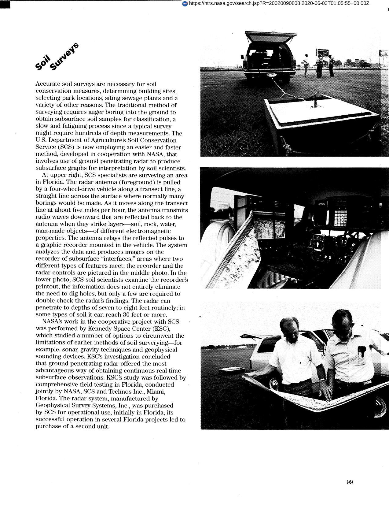
An accurate method of surveying the soil was developed by NASA and the Department of Agriculture. The method involves using ground penetrating radar to produce subsurface graphs. By examining printouts from the system's recorder, scientists can determine whether a site is appropriate for building, etc.
Full article: http://hdl.handle.net/hdl:2060/20020090808
Abstract
An accurate method of surveying the soil was developed by NASA and the Department of Agriculture. The method involves using ground penetrating radar to produce subsurface graphs. By examining printouts from the system's recorder, scientists can determine whether a site is appropriate for building, etc.
Soil Surveys
Soil Surveys


