
Softer Moon Landings for Companies
Subheadline
NASA helps private sector soar with better navigation technology
After NASA patented a laser-based technology to enable more precise Moon and Mars landings, the space agency licensed the innovation in 2016 to Psionic Inc. of Hampton, Virginia, which has continued to advance it with NASA support.
Psionic was founded by former NASA employees who had worked on the technology at the agency’s Langley Research Center, also located in Hampton. The company identified Earth-based applications (Spinoff 2020) for the technology, which is called Navigation Doppler Lidar, or NDL, while at the same time improving its space navigation and landing capabilities for both NASA and commercial missions.
NASA has continued to work with Psionic on the technology under Space Act Agreements and has also bolstered the company’s efforts through multiple Small Business Innovation Research contracts and Game Changing Development program projects.
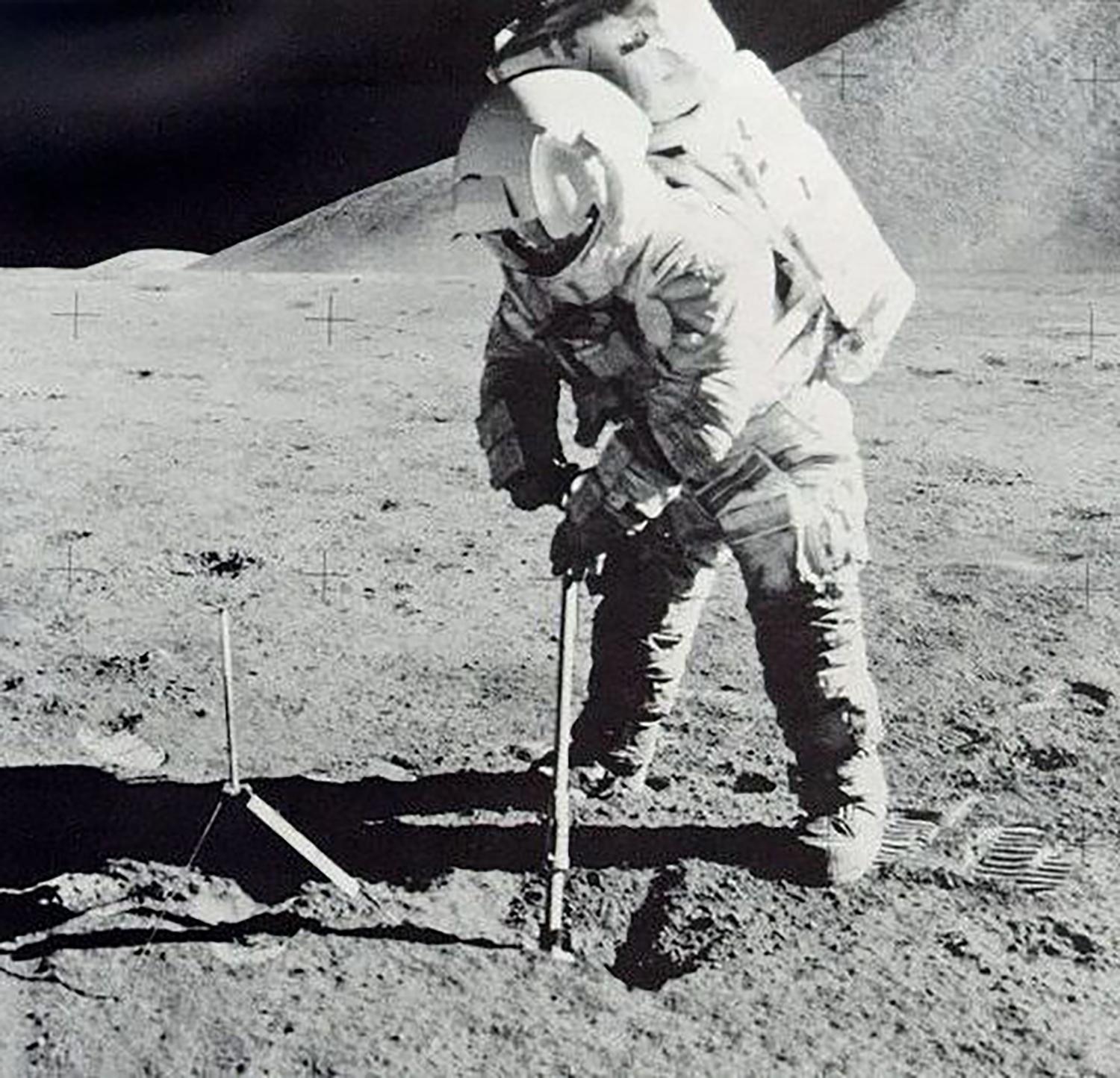
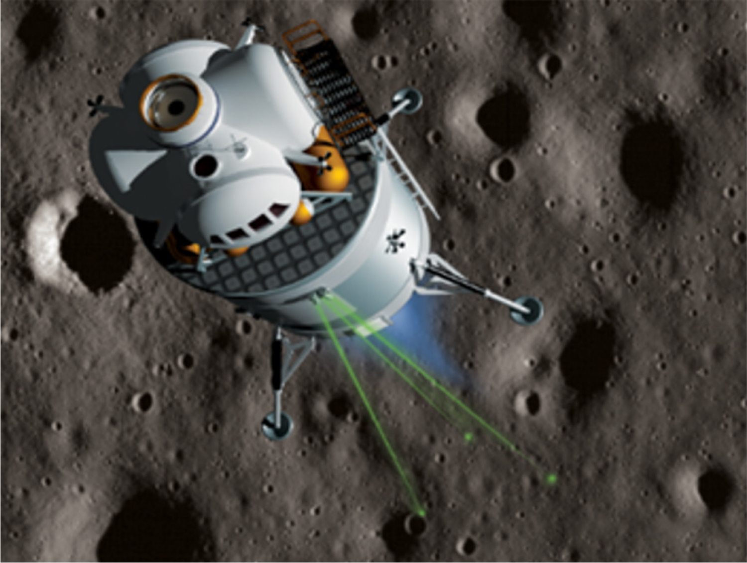
NDL determines the precise position and speed of a spacecraft using a technique similar to Doppler radar but based on light instead of microwaves. The device emits multiple laser beams at different angles toward a planetary surface that bounce back to the sensor, with variations in frequency and timing providing measurements of both altitude and velocity.
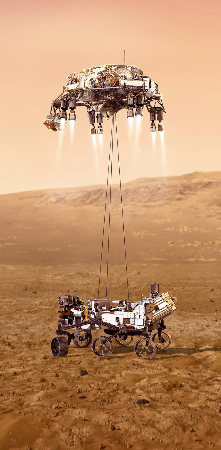
The technology was part of the first commercial lunar landing, a 2024 mission by the company Intuitive Machines through NASA’s Commercial Lunar Payload Services, or CLPS, initiative. That program contracts out lunar missions to private companies to achieve research goals and spur the commercial space industry at the same time.
The NDL used in the Intuitive Machines mission was built by NASA, but Psionic built the same device, under its license, to be the primary altimeter for another CLPS mission, Astrobotic’s Griffin lander, slated for a late 2025 launch.
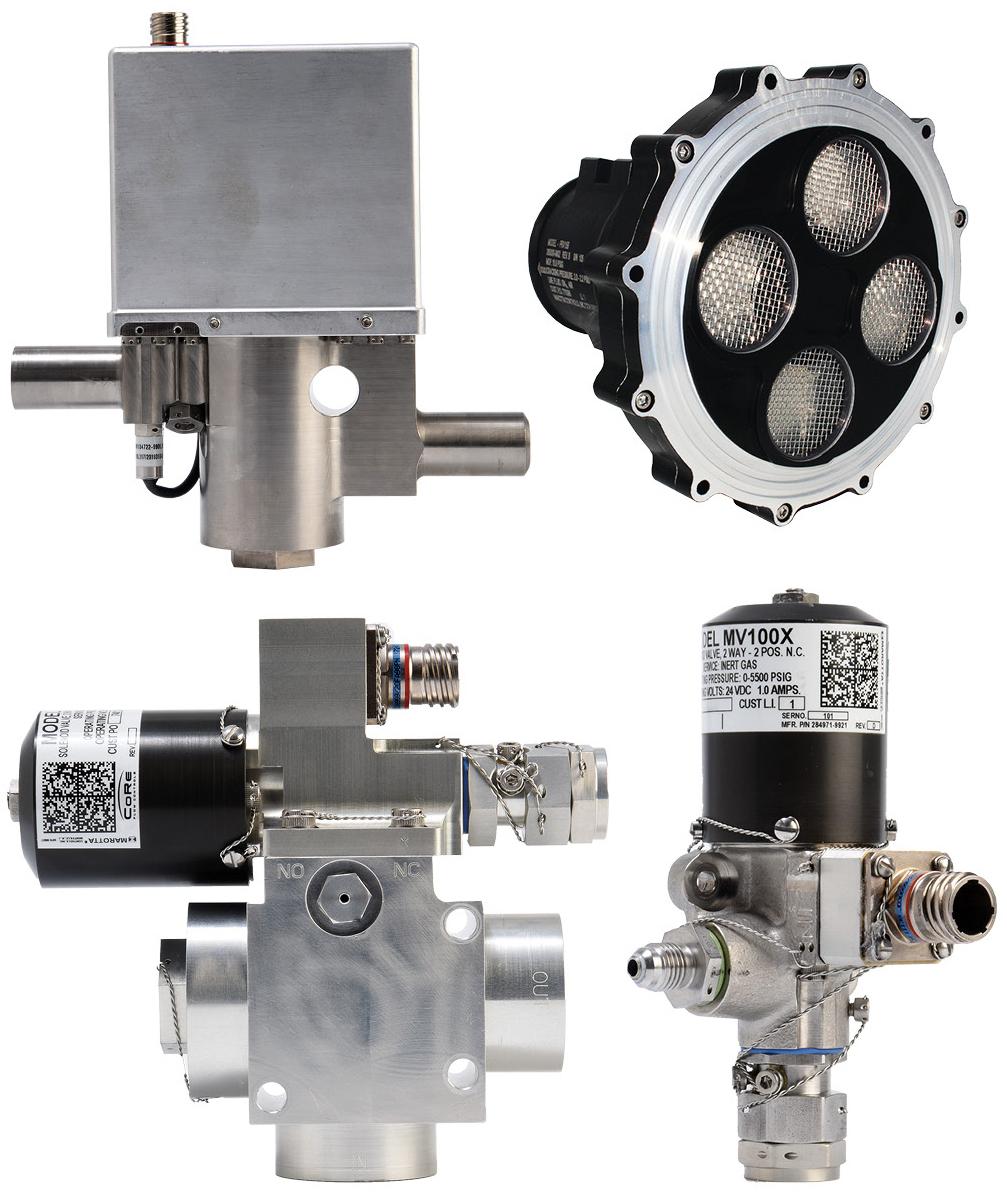
Psionic has also further developed navigation doppler lidar with its own version of the device, PNDL for Psionic NDL, which is less than half the size and weight of the current NDL, expands the operating range, decreases power requirements, and adds other improvements.
PNDL’s scanning capabilities can assist autonomous docking, for instance with a space station or other spacecraft. The technology is being integrated into Axiom Space’s commercial space station, which is currently under construction.
PNDL’s scanning functions also facilitate surface navigation, enabling lunar rovers, for instance, to avoid boulders or craters. Psionic said it is working with several companies that are building lunar rovers.
Farzin Amzajerdian, the senior scientist at NASA Langley who led the team that invented NDL, said transferring licenses to companies like Psionic helps the space agency achieve its goals. “We actively try to transfer our technology,” he said. “It’s actually a bragging point for NASA. It’s an accomplishment each year to say how many technologies have been transferred to industry.”
NDL, which was coinvented by Diego Pierrottet, who is now Psionic’s chief engineer, won NASA’s 2022 Invention of the Year award in the commercial category.
“We’re not only reaping the benefits of this technology transfer,” said William Cook, senior vice president of space operations at Psionic. “We’re helping NASA and commercial partners navigate with greater confidence than ever before.”
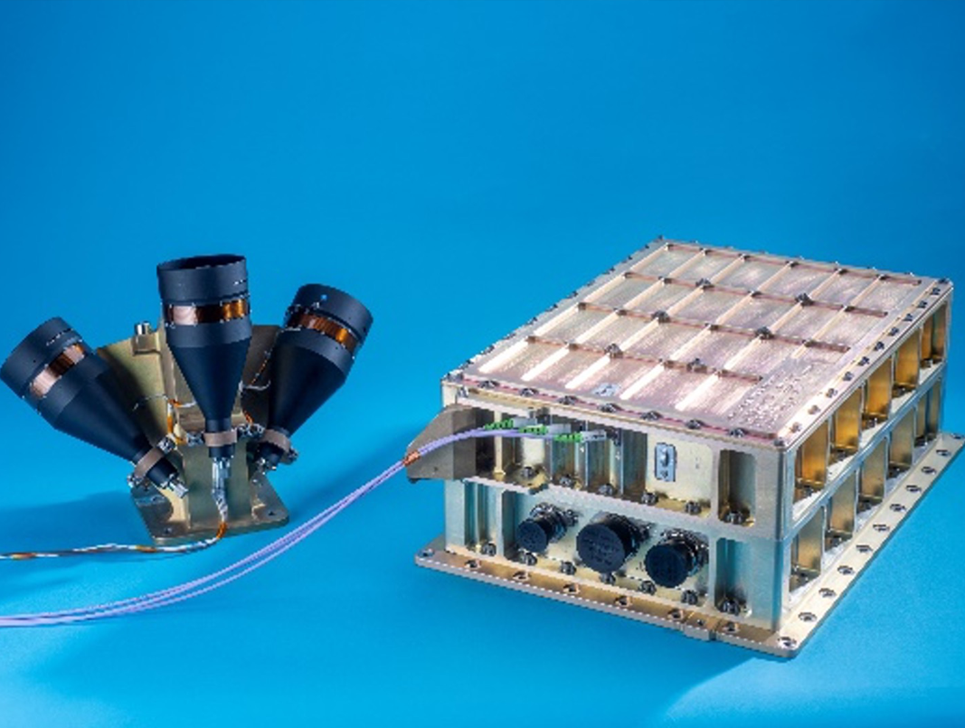
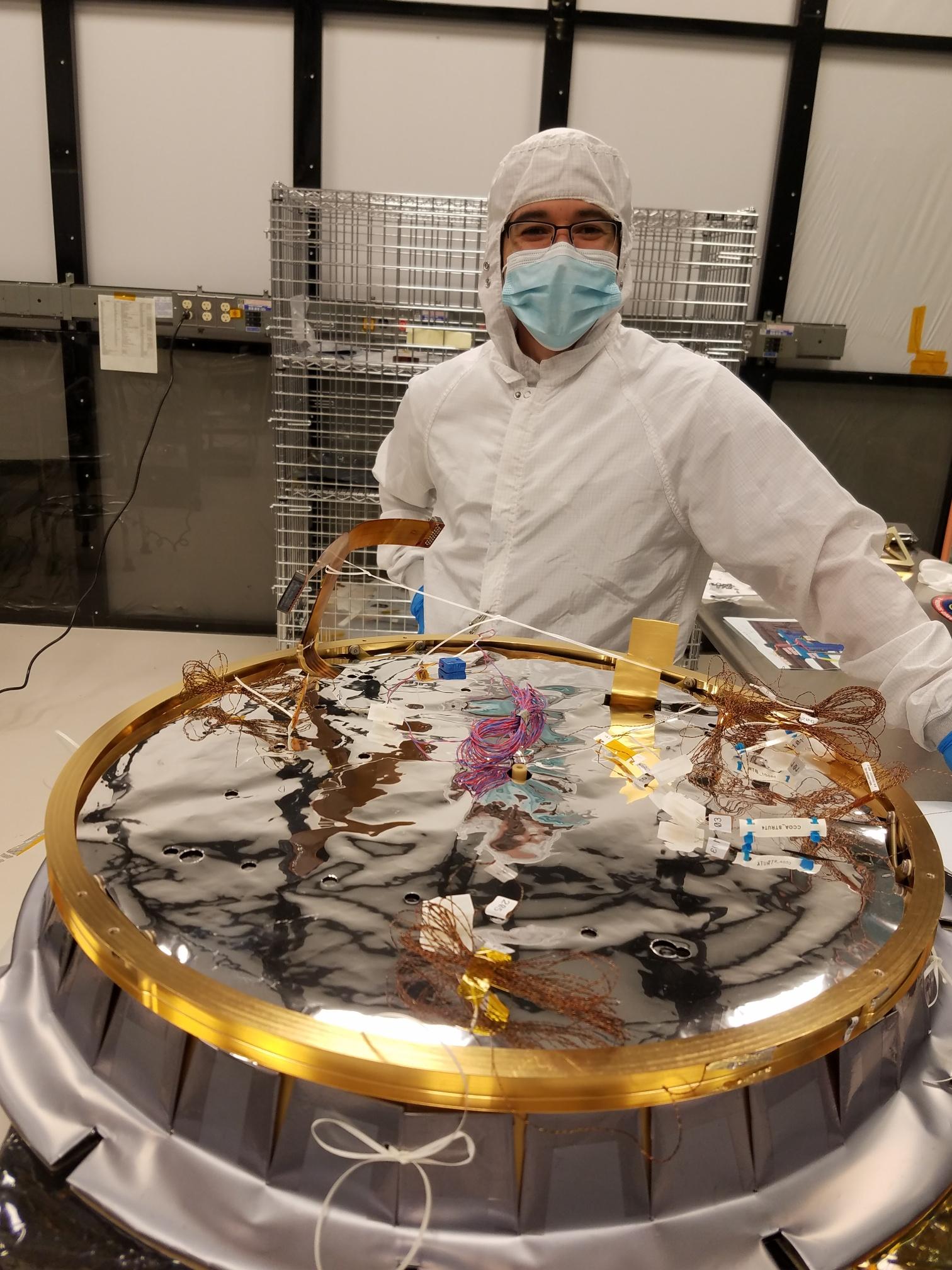
Navigation Doppler Lidar was invented at NASA’s Langley Research Center before the agency licensed it to Psionic of Hampton, Virginia. Credit: NASA
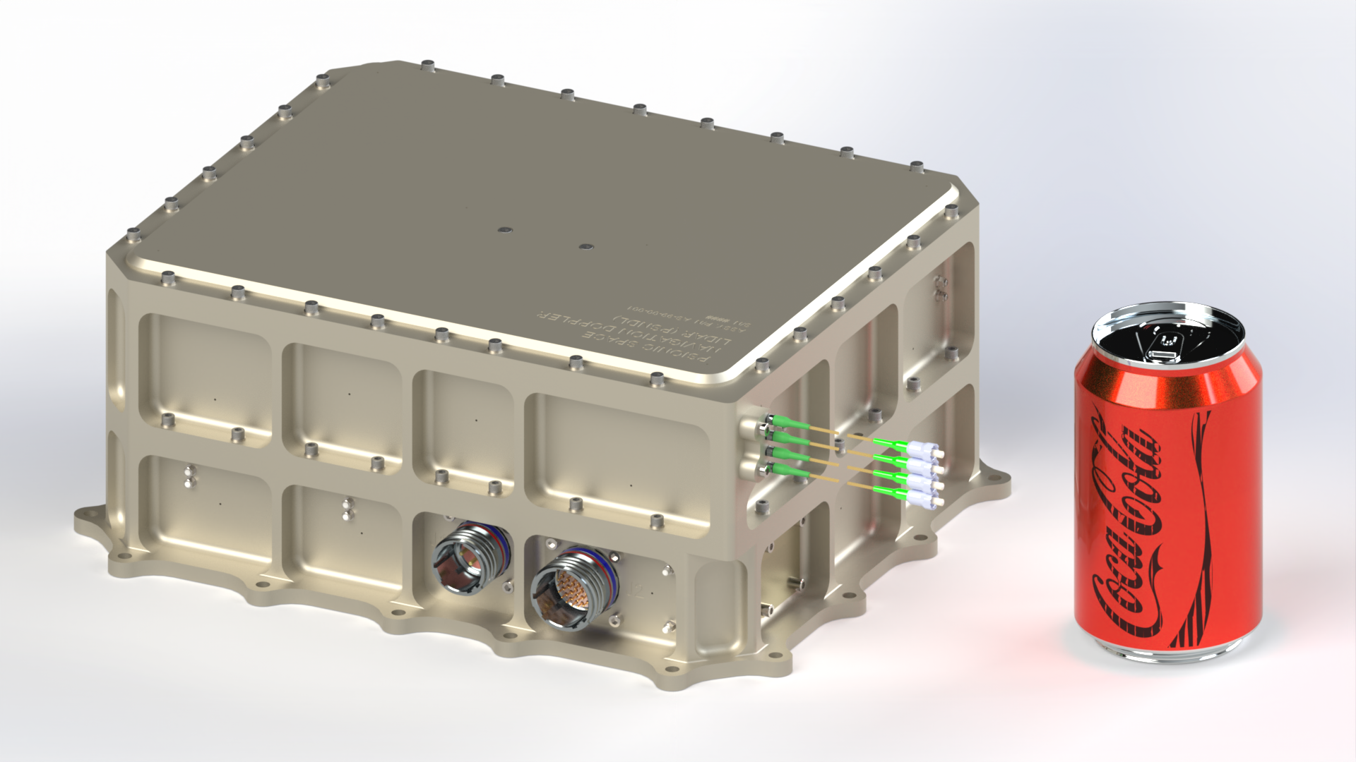
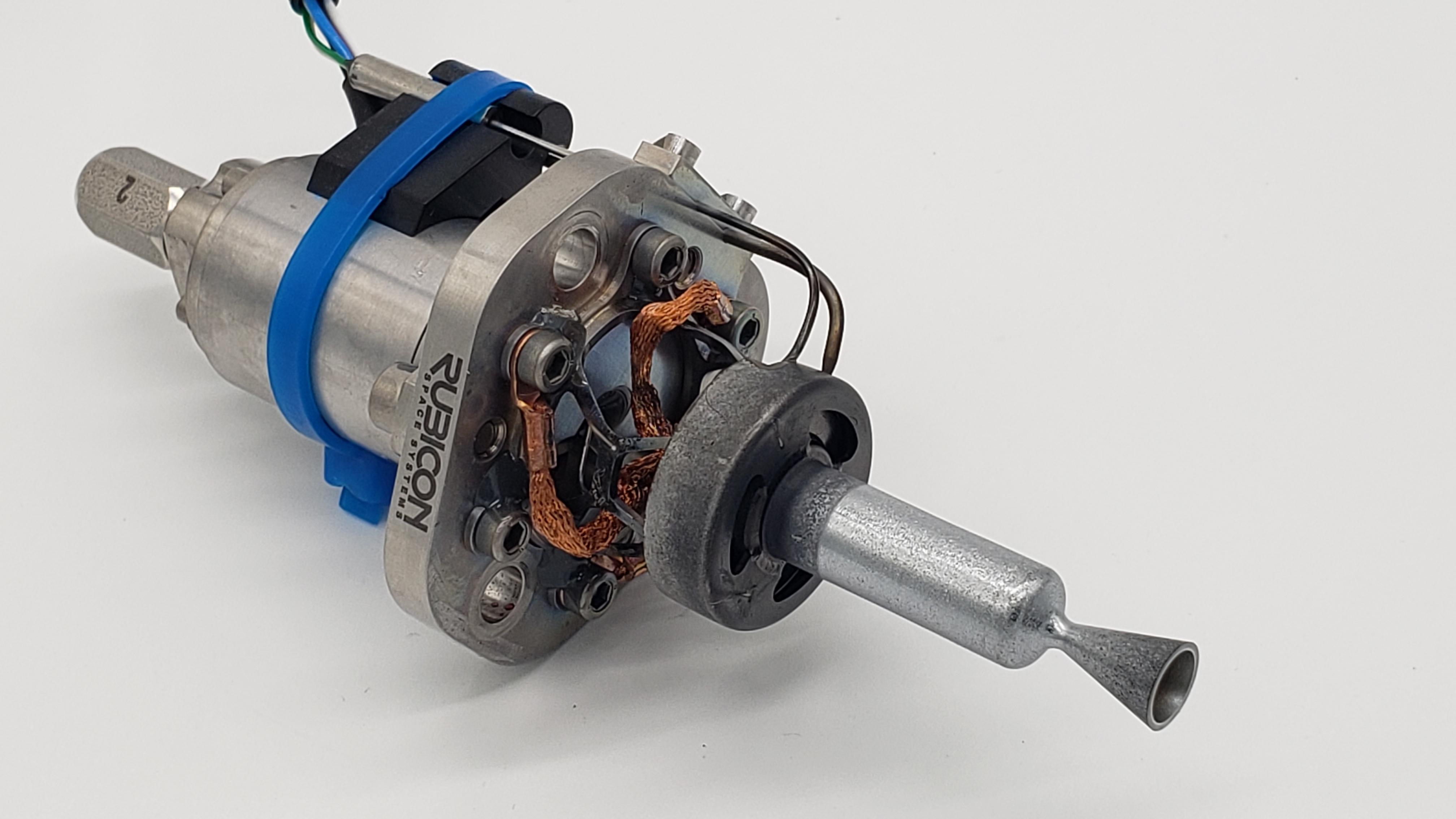
The Psionic Navigation Doppler Lidar, pictured here next to a soda can for scale, is less than half the size and weight of the device the company licensed from NASA. Credit: Psionic Inc.
Navigation Doppler Lidar devices send out laser beams that bounce off planetary surfaces, revealing information about a lander’s altitude and velocity. The technique is similar to Doppler radar but based on light instead of microwaves. Credit: NASA