

Antennas Lower Cost of Satellite Access
Originating Technology/NASA Contribution
Whether for scientific inquiry, weather forecasting, or public safety, the world relies upon the data gathered by satellite remote sensing. Some of NASA’s most valuable work is in its remote sensing capabilities—the ability to retrieve data acquired at great distances—affording a height and scope not available from the ground. NASA satellites in low Earth orbit (LEO) monitor ocean health by taking large-scale pictures of phytoplankton blooms and measuring surface temperatures; snap photographs of full hurricanes from above, teaching researchers about how these giant storms form; and capture images of cloud formation and air pollution, all allowing researchers to further develop understanding of the planet’s health. NASA remote sensing satellites also monitor shifts in the Earth’s crust, analyze wind patterns around the world to develop efficient wind energy, help people around the world recover from natural disasters, and monitor diminishing sea ice levels.
Just as researchers are more heavily relying on this data from space to conduct their work, the instruments carried on satellites are getting more sophisticated and capable of capturing increasingly complex and accurate measurements. The satellites are covering larger areas, from farther away, and generating more and more valuable data.
The ground-based receivers for this wealth of satellite data have grown increasingly capable of handling greater bandwidth and higher power levels. They have also become less expensive, through a NASA research partnership, with the creation of a high-rate X-band data receiver system that is now in widespread use around the globe.
Partnership
SeaSpace Corporation, of Poway, California, recognized a need for developing economical systems for receiving, processing, analyzing, and archiving incoming data from X-band remote sensing satellites, as they already provided similar systems for L- and S-band satellites. This need was one experienced throughout the world, as people became more reliant upon high-resolution satellite data. This was especially true within NASA, where the Space Agency could save millions of dollars by having available commercial providers of low-cost satellite data receivers accommodate its remote sensing program needs.
The company approached NASA’s Jet Propulsion Laboratory with proposals for a two-part research project to create such a system and was granted funding under two Small Business Innovation Research (SBIR) contracts, a Phase I and follow-on Phase II. SeaSpace proposed that its reception and processing systems could reduce the cost of satellite ground tracking by at least a factor of 10, and that the profits from its commercial sales would lead to even more enhancements to the receiver systems, extending applications to land-use management, marine pollution tracking, polar science operations, and ultimately, widespread commercial adoption of its product.
Product Outcome
SeaSpace engineers were already pioneers in the field of ground-based direct reception stations, and under the NASA SBIR projects, they developed both new hardware and software to help with the acquisition of satellite data. The company was already working with the nearby San Diego-based Scripps Institution of Oceanography, and so applied its radio frequency equipment to an existing Scripps antenna platform to capture high-rate data from EOS-1 (an Earth-observing satellite). SeaSpace also designed and implemented the software necessary to control the antenna frame and process the data, which was later added to their existing TeraScan software product. This proved the viability of the ground-based antenna for receiving X-band.
Once the company had demonstrated the usability of this ground station, interested parties took note, and SeaSpace began taking orders. To date, the company has installations in over 35 countries and has sold over 50 X-band systems, adding to an extensive list of customers reaching over 450 TeraScan systems worldwide. Its ground-based receivers are in continuous operation on all seven continents, with customers including aerospace and defense clients, the scientific community, national and local weather services, the research industry, and public safety organizations.
Clearly, these customers appreciate the lower price of the units, but in addition to the cost savings (approximately one-tenth the cost of conventional antennas), SeaSpace ground stations, with sizes ranging from 0.6–6.1 meters, have additional benefits. Able to receive data from multiple platforms, they are available for a variety of applications: tracking LEO satellites for remote sensing; science; communications; and telemetry, tracking, and command applications, providing true full hemispherical coverage.
The units require very little maintenance, are reliable with redundancy motors and drives, and have a high level of remote fault detection and fault isolation. A minimal amount of moving parts, extremely low tracking dynamics, and few components all contribute to the ability of this antenna system to run for long periods without downtime. Their ruggedness combined with the ability to run around the clock make these antennas ideal for unattended, remote-controlled use in severe environments.
The first X-band system sold by SeaSpace was purchased by the University of Wisconsin’s Space Science and Engineering Center (SSEC), in Madison. The department receives, manages, and distributes large amounts of geophysical data and develops software to visualize and manipulate these data for use by researchers and operational meteorologists all over the world. To aid in this work, the SSEC hosts a 4.5 meter SeaSpace X-band system.
The U.S. Navy uses SeaSpace systems for operation flight plans and monitoring dust storms in Iraq and Afghanistan. While this function saves the engines of F-16s by alerting pilots and ground controllers about the threat of the small but invasive airborne debris, it also saves lives. Ground troops can know in advance not to move into an area when they are not going to be able to receive support from the air. Battlefield planners can use the data to make smarter, safer decisions about where to send troops.
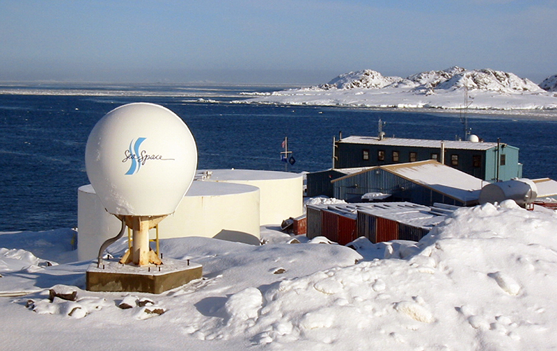
Another customer, Raytheon Polar Services Company, has two of the systems deployed at literally the far end of the Earth: one at McMurdo Station, a large American research center off of Ross Island in the Antarctic, and the much smaller Palmer Station, located on Anvers Island, just north of the Antarctic Circle. Both of these remote research stations are operated by the National Science Foundation, which has a contract with Raytheon for the company to provide this support. At McMurdo, for example, the outdoor ground-based systems experience an average monthly temperature of -18 °C and average wind speeds of 11 miles per hour. With weather like that, it is important that the systems are rugged so they can endure, but also so that researchers do not often have to slough out into the cold to repair or maintain the equipment.
In a warmer climate, Mexico, the National Commission for the Knowledge and Use of Biodiversity (CONABIO), a government agency dedicated to coordinating, supporting, and executing activities and projects designed to increase regional understanding of biodiversity, uses a 2.4-meter SeaSpace X-band system. CONABIO produces and collates biodiversity data and assessments across Mexico’s varied ecosystems. It consolidates this information and guides a range of biological conservation and sustainability projects using the satellite data.
TeraScan® is a registered trademark of SeaSpace Corporation.
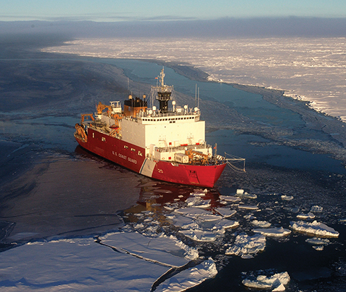
U.S. Coast Guard cutters use the SeaSpace antennas to determine how thick the Arctic ice is. They are then able to cut channels through the ice.
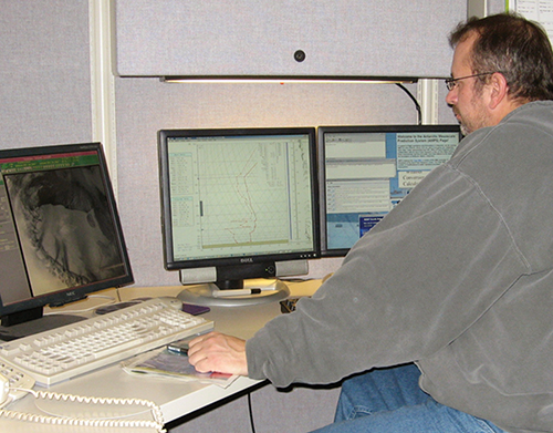
SeaSpace Corporation provides satellite data acquisition for a variety of uses, including weather monitoring and environmental monitoring.
From weather, oceanography, and environmental studies to disaster management and military operations, SeaSpace’s ground systems are the complete acquisition and data processing solution for every major polar orbiting X-band satellite.


