
Feeding People Through Disasters
Subheadline
NASA satellite data helps build maps for first responders, including chefs and other food support
In the aftermath of a disaster, whether it’s a bombing or a hurricane, a flood or a wildfire, people still need to eat. So when access to food and water becomes difficult or impossible, chefs from around the world mobilize to provide free meals. World Central Kitchen, a nonprofit organization “providing meals in response to humanitarian, climate, and community crises,” orchestrates the work of preparing fresh food and providing drinking water. Offering support to those hard-hit communities often requires a map that relies on NASA satellite data.
Advance teams coordinate logistics, including security and communications, so they need to know the terrain, where resources are located, and the damage done to infrastructure. Online maps allow a user to zoom in and out to view any part of a community, and different layers of information can be added or removed based on the data needed, according to Ali Sharman, former mapping specialist for World Central Kitchen. Details such as population centers, restaurant locations, food pickup locations, and the travel routes to reach isolated pockets of people are just a few of those layers. Logistics teams on the ground also provide a constant flow of information about conditions that’s continually added to the data warehouse the organization maintains to develop up-to-date maps throughout an event.
“NASA makes itself very available, both in terms of personal contact and data,” said Sharman. “Open data is what allowed me to do my work quickly. NASA has done a great job making their data very accessible and easy to find and use.”
To create electronic and even paper maps, one of the first places World Central Kitchen turns for regional data is NASA’s Disasters Response Coordination System, an agencywide initiative with its program office at NASA’s Langley Research Center in Hampton, Virginia.
In addition to the most comprehensive long-term view of Earth’s surface, provided by the Landsat satellites, multiple sensors on satellites in low Earth orbit provide near-real-time data during and after disasters. Anyone can access that data from NASA’s website, or users can request assistance for specific events. The Disasters Mapping Portal is open-access, and most of the information can be downloaded.
“Our role is to connect the scientists at each center or the subject matter experts — people who generate the actual science and datasets — to the response agencies or organizations such as World Central Kitchen,” said Rachel Vershel, disaster response coordinator for NASA’s Goddard Space Flight Center in Greenbelt, Maryland. Launched in June 2024, the Disasters Response Coordination System brings together a wealth of NASA’s Earth science information from across the agency, continuing a decades-long effort to make data available.
‘A Visual Language’
Working alongside local chefs in Haiti after an earthquake in 2010, chef José Andrés saw an unmet need for nutritious and comforting food as people were trying to rebuild their lives. Along with his wife, he created World Central Kitchen to feed survivors, first responders, and anyone in need after a disaster. Whether the catastrophe is caused by humans or nature, a worldwide network of staff and volunteers responds in the immediate aftermath. Based in Washington, the organization builds partnerships with local chefs, restaurants, food trucks, food suppliers, and others to prepare and distribute meals while supporting the local economy.
The belief that food is a human right powers World Central Kitchen’s staff and volunteers. Coordinating the logistics of getting food to people depends on accurate and continual data updates. For example, food safety can be tricky.
“When you work with hot meals, you have a four-hour window to deliver that meal at a certain temperature before you hit a food safety issue.
The timing is very important to our team, in terms of where we can safely deliver food,” said Sharman, noting that the maps also serve as an orienteering tool.
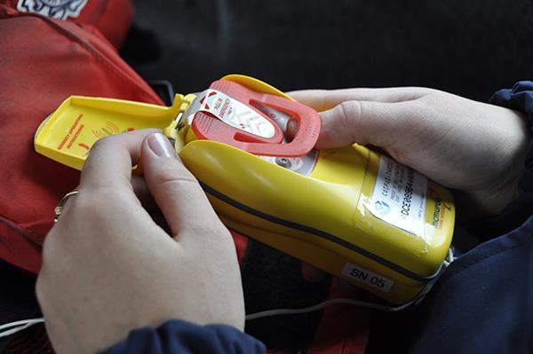
Even if internet access and GPS service aren’t available, regional electronic maps containing saved wayfinding datapoints provide a base map to which saved data can be added. Once internet access is available, World Central Kitchen’s online portal also allows staff and volunteers to share, view, and download real-time data. But frequently, Sharman received requests for large paper maps for use in the field.
These can often serve a function that online maps don’t, she said, as proved to be the case in 2023 during the aftermath of an earthquake in a mountainous region of Morocco that destroyed buildings and caused rockslides, making roads impassable. Just finding the people who needed food was a challenge. Then there was the language barrier in a country where not all the staff and volunteers spoke the local dialect.
“When I was in Morocco, I was sitting outside a kitchen with a large map laid out,” said Sharman. “Suddenly all of the drivers surrounded me and started pointing at the map and telling me where their villages were. A map is a universal language, it’s a visual language.”
‘The Very Best in People’
In advance of Hurricane Helene’s 2024 landfall in Florida, Rapid Response Field Kitchens developed by World Central Kitchen were positioned for delivery to places like Big Bend, where volunteers delivered the food to residents on foot and by offroad vehicles.
In the wake of the same storm in North Carolina, World Central Kitchen used helicopters to deliver sandwiches, water, and baby formula to mountain communities isolated by washed-out roads. Local food trucks were hired in Georgia and Tennessee to distribute meals to people far from the larger distribution centers and restaurants in cities. Throughout, NASA data supported these efforts to bring together the comfort of food and community, said Sharman.
“You see people in their very worst moments, and yet it seems to bring out the very best in people. It’s a beautiful thing that happens amid tragedy,” she said. Sharman sees the same generosity of spirit in the effort NASA puts into preparing and providing the satellite imagery and data that enable the maps aid workers require.
Just a few of those resources include the Fire Information for Resource Management System, which provides active fire data from the Moderate Resolution Imaging Spectroradiometer instruments aboard the Aqua and Terra satellites and the Visible Infrared Imaging Radiometer Suite (VIIRS) instruments aboard three other satellites. Aqua and Terra also generate flood data, and VIIRS contributes climate information. The website and mobile app make it easy to download and incorporate NASA data into mapping programs like the one World Central Kitchen uses.
Because each disaster is different, the information World Central Kitchen and other organizations need is ever changing. Dedicated NASA staff maintain relationships with businesses, nongovernmental organizations, and government entities such as the Federal Emergency Management Agency to be ready for a quick response when those emergencies arise.
The Black Marble
Some of the relief efforts NASA has supported include the 2022 volcanic eruptions in Hawaii, the 2020 chemical explosion in Beirut, and multiple landslides around the world. The most frequently requested data is for cyclones or hurricanes, flooding, and wildfires, but event-specific datasets remain available in NASA’s Disasters Mapping Portal. Agency teams only stop adding new information when they confirm the work on the ground has transitioned to recovery and rebuilding is underway.
However, not all the data ends there.
“The Black Marble is a power-outage product that’s used long into the recovery phase,” said Vershel. “You start seeing nighttime lights come back on and what areas likely still don’t have power. That’s really important.” This kind of information helps government entities and those working in the area track the recovery process.
Agency expertise in compiling and sharing data makes a difficult situation more manageable, according to Sharman.
“Things like digital elevation models that NASA has been publishing for a really long time carefully piece together satellite data about the structure of Earth’s surface,” she said. “When I need something specific, I can email someone at NASA, and they’ll email back very quickly and be able to tell me exactly what I need to know.”
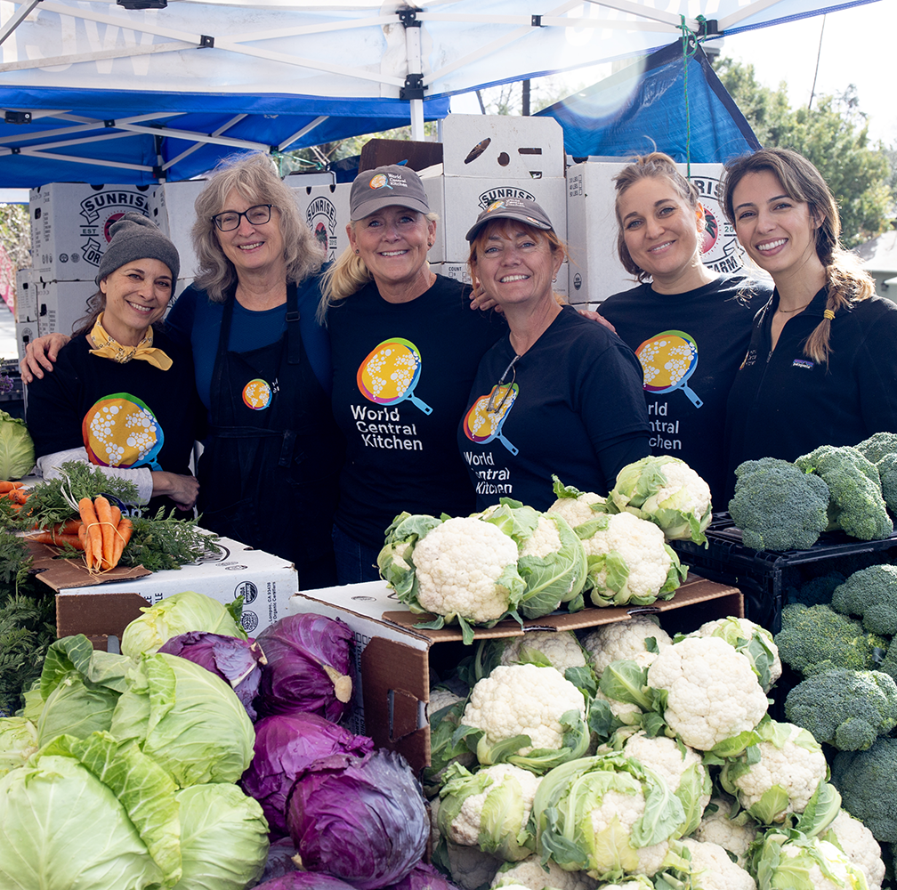
In addition to providing meals, World Central Kitchen (WCK) also trucks in drinking water and offers a biweekly farmer’s market to provide fresh fruits and vegetables at no cost. Local produce and other ingredients are purchased whenever possible to support the local economy in a time of crisis. Credit: World Central Kitchen
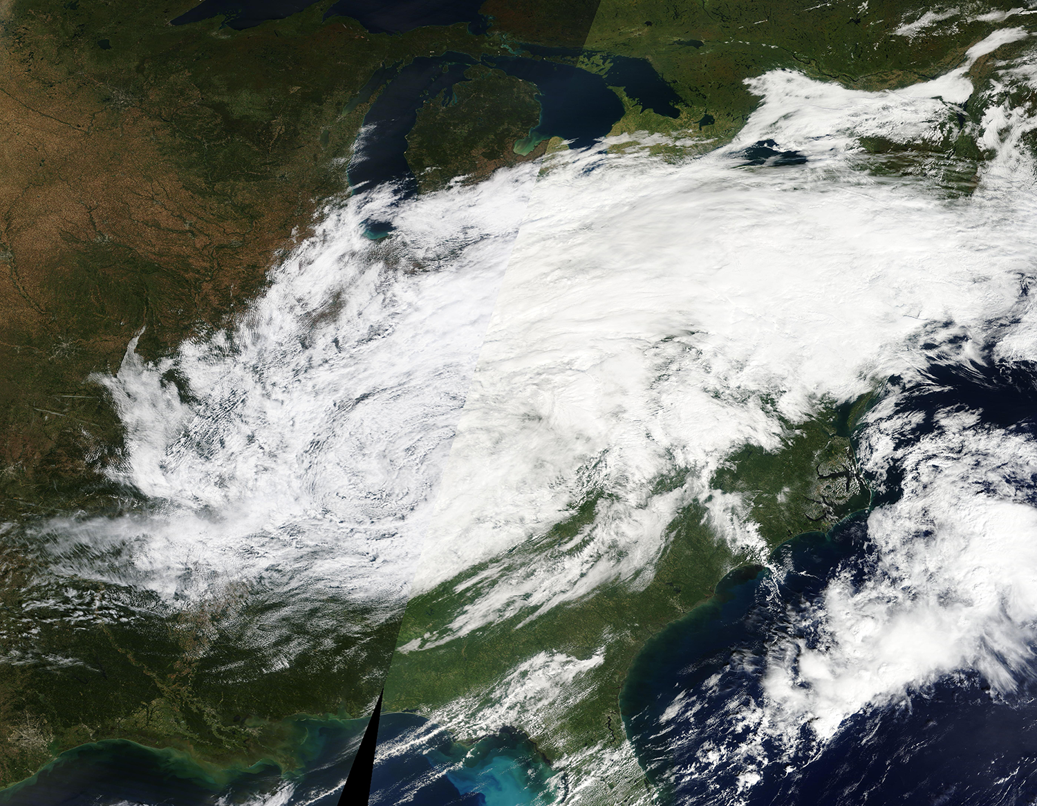
The Moderate Resolution Imaging Spectroradiometer on NASA’s Terra satellite is one of the data sources WCK uses to build area maps for staff working in disaster areas like North Carolina, where the remnants of Hurricane Helene, pictured here, caused historic flooding in 2024. Credit: NASA

Setting up field kitchens in the wake of a disaster like Hurricane Fiona in Puerto Rico is one way WCK prepares food for distribution to the devastated community. Credit: World Central Kitchen
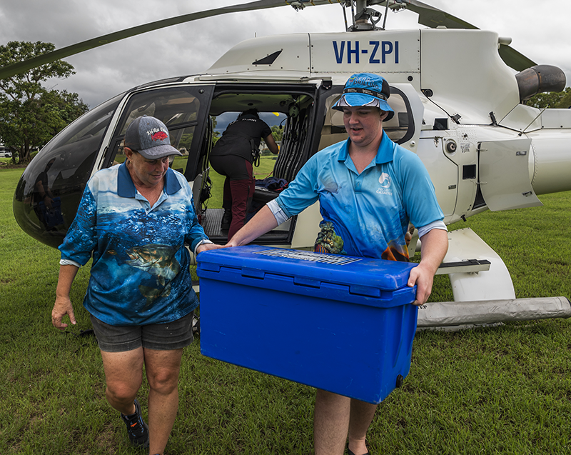
When physical barriers or transportation issues prevent people from getting to food distribution sites, volunteers take food directly to people — by helicopter, offroad vehicles, or foot. Credit: World Central Kitchen
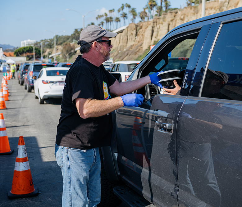
Meals prepared by WCK staff and volunteers in a central kitchen are served cafeteria-style when a facility is available, but often meals are packaged for distribution or for people to pick up, as in this location in Southern California. Credit: World Central Kitchen
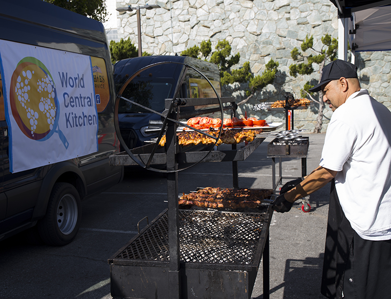
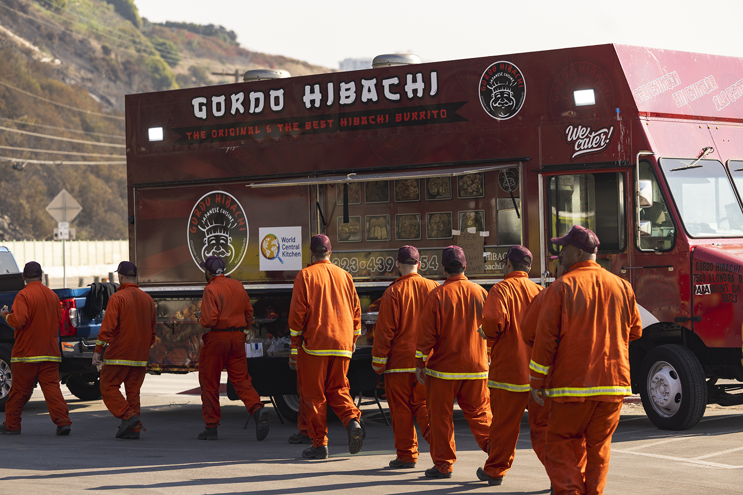
Local chefs who know the food preferences of a geographic area guide menus designed to bring food and comfort to communities. WCK also hires local food trucks to reach as many people as possible. Credit: World Central Kitchen
WCK, a global nonprofit, mobilizes local chefs and resources to serve free hot meals during disasters like the wildfires in Southern California in 2024 and 2025. Credit: World Central Kitchen