
Living Off Our Moon
Subheadline
NASA lunar data to find resources informs technology, mission planning
The barren lunar landscape has some resources, such as water and minerals like iron and titanium, but extracting and processing them will require special equipment. Where those resources can be found will dictate where to land and how to mine them. To help with that, Lunar Station Corp. is using a wealth of NASA data in multiple computer models.
“With 60 years of lunar data available to us, we help our clients understand the environmental factors for any given location on the Moon,” said Blair DeWitt, CEO of Lunar Station. Combining disparate data from different sensors used by NASA and other space agencies is a critical first step. One NASA resource the Cambridge, Massachusetts-based company used to build terrain maps is the Ames Stereo Pipeline. The open-source code automatically processes images captured from satellites, robotic rovers, historical images, and more to create a 3D model revealing features such as rock placement and elevation.
The availability of in-situ lunar water resources at any location is largely unknown, according to Gerry Sanders, in-situ resource utilization system capability lead at NASA’s Johnson Space Center in Houston.
“We have reasonably good information about the lunar regolith itself through orbiter sensors and the Apollo samples,” said Sanders. “But we don't know a lot about where or in what form water might be in permanently shadowed craters.” To begin to fill that gap, the Lunar Crater Observation and Sensing Satellite was designed to crash its uppers stage into the Moon’s South Pole in 2009. The examination of the resulting plume revealed the presence of water ice. The agency is using this and other data to develop the hardware and processes necessary to extract those resources.
Lunar Station is building on that work to help commercial space companies with their mission planning, which includes scientific research for mining operations. The company's MoonHacker program uses its proprietary geospatial analytics platform and advanced algorithms to fuse all the lunar data in NASA's Planetary Data System to help identify indicators for shallow pits of lunar water.
MoonHacker includes models to identify the environmental factors for any given location on the Moon, including minerals, water, and topography elements such as slope and sunlight. NASA’s Advanced Composition Explorer, a deep space satellite, also provides data about space radiation. In MoonHacker’s Radiation Simulator, an electronic version of a company’s rover or satellite, called a digital twin, can be subjected to the radiation en route or at the mission site to determine the protection required.
“Electronics do not like radiation, and we can identify the need for more or less radiation shielding. That saves customers money on design and launch costs.” said Dr. Fredrick A. Jenet, head of technology at Lunar Station.
“We can find sites for landing pads, for cultivating the best paths for roving, and inform our clients about communications. If you can’t see Earth at a given location like in the polar regions or the far side of the Moon, you have to come up with a relay strategy,” said DeWitt. “We can do this in part thanks to NASA data that has been sensed and stored over more than six decades.”
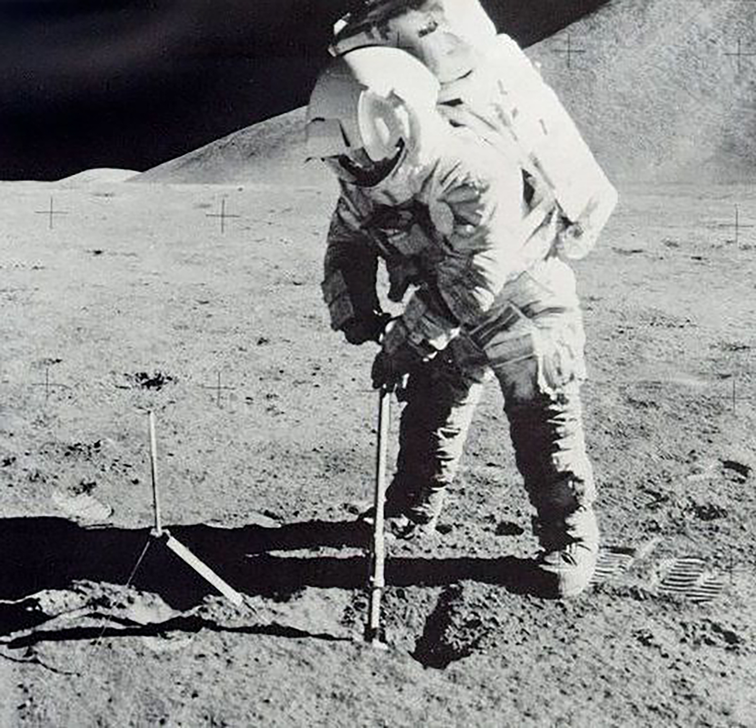
Apollo 15 astronaut Jim Irwin uses a scoop to collect soil samples on the lunar surface. In 2009, the Lunar Crater Observation and Sensing Satellite (LCROSS) was intentionally crashed into the Moon, sending up a plume of dust. Both helped to confirm the presence of frozen water. Credit: NASA
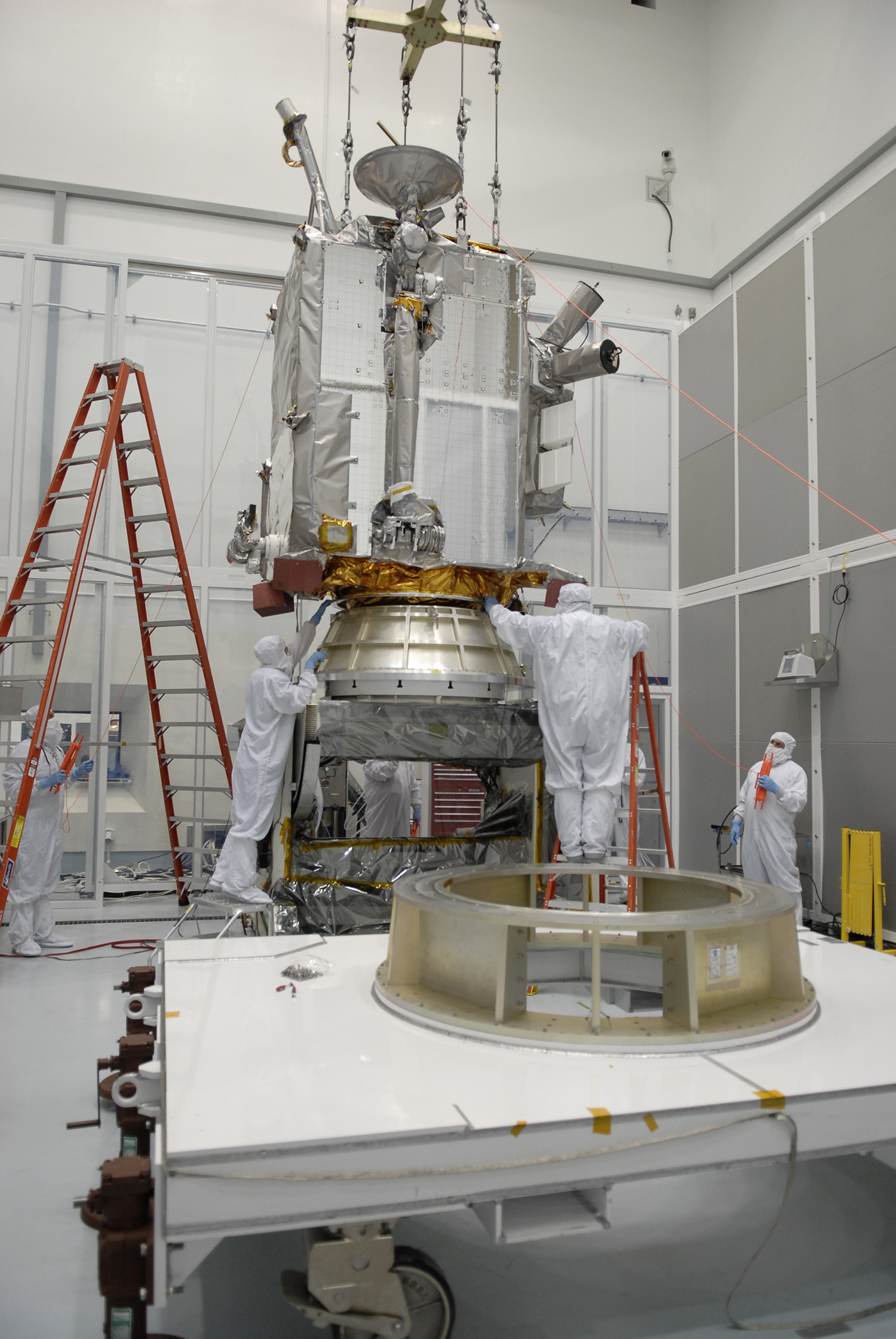
The Lunar Reconnaissance Orbiter carries seven instruments to create detailed maps of the lunar surface, enhancing our understanding of the Moon's topography, lighting conditions, mineralogical composition, and natural resources. The satellite also took LCROSS into lunar orbit. Credit: NASA
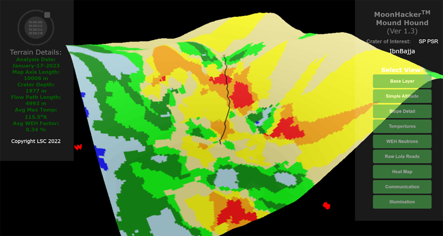
This multi-colored terrain map generated by the Moon Hacker program indicates the likely location of water in a permanently shadowed crater on the lunar surface. Multiple data sources make it possible to identify the best locations (in red), and the black line is a proposed rover path into the area. Credit: Lunar Station Corp.
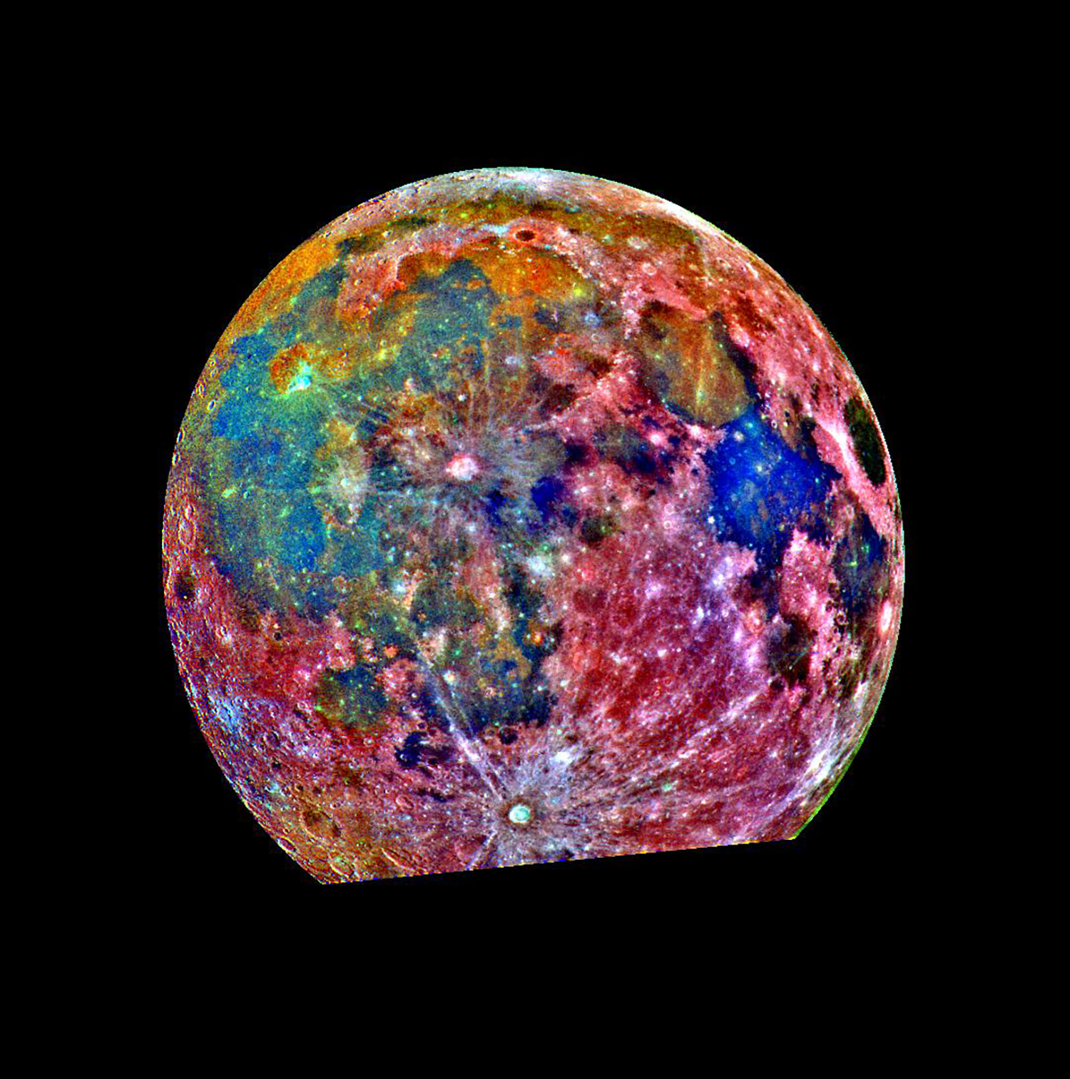
NASA has been taking pictures of the Moon for decades, collecting a wealth of data. This false-color picture is a composite of 15 images of the Moon taken through three color filters on NASA's Galileo solid-state imaging system. Credit: NASA