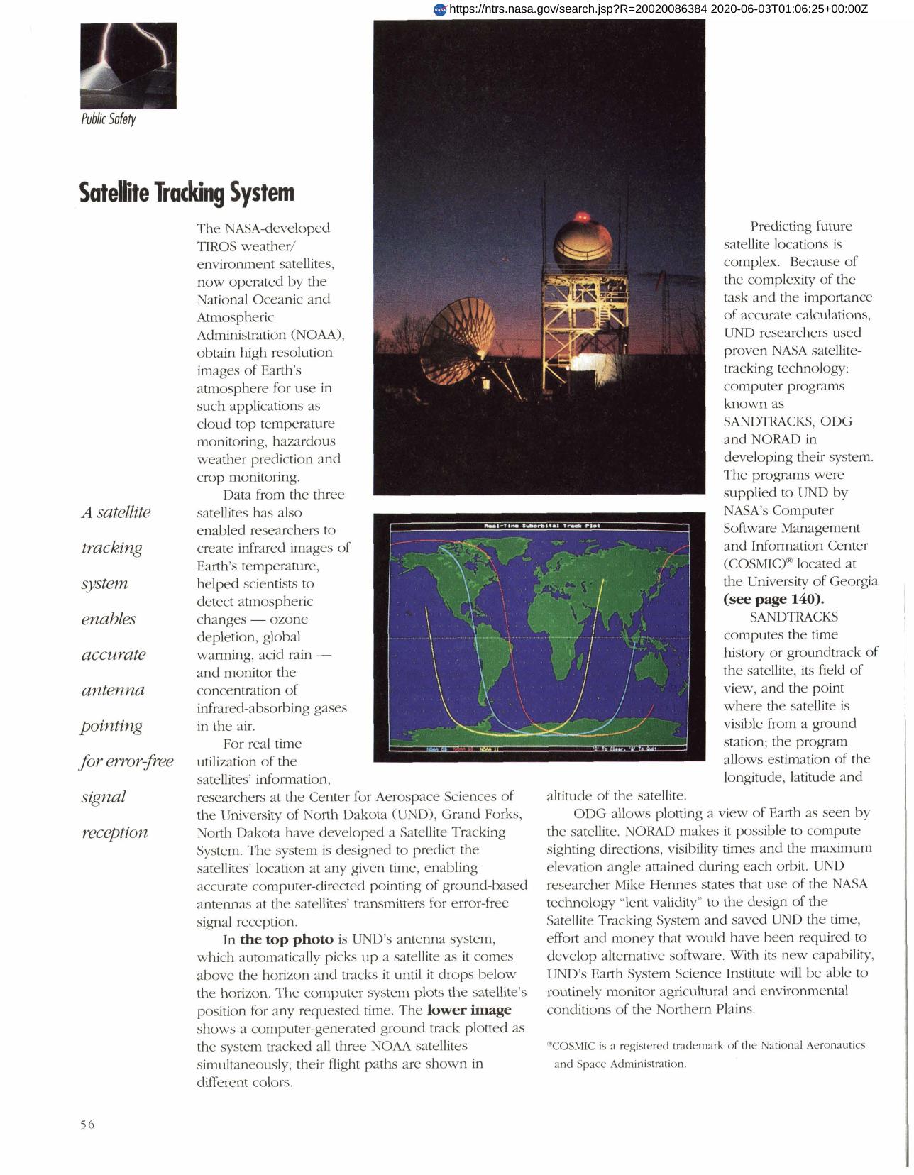

Satellite Tracking System
Researchers at the Center for Aerospace Sciences of the University of North Dakota (UND), Grand Forks, used three NASA Computer programs (SANDTRACKS, ODG, NORAD) to develop a Satellite Tracking System for real time utilization of TIROS weather/environment satellite information. SANDTRACKS computes the satellite's position relative to the Earth. ODG allows plotting a view of Earth as seen by the satellite. NORAD computes sight direction, visibility times and maximum elevation angle during each orbit. With the system, UND's Earth System Science Institute will be able to routinely monitor agricultural and environmental conditions of the Northern Plains.
Full article: http://hdl.handle.net/hdl:2060/20020086384
Satellite Tracking System
Satellite Tracking System