
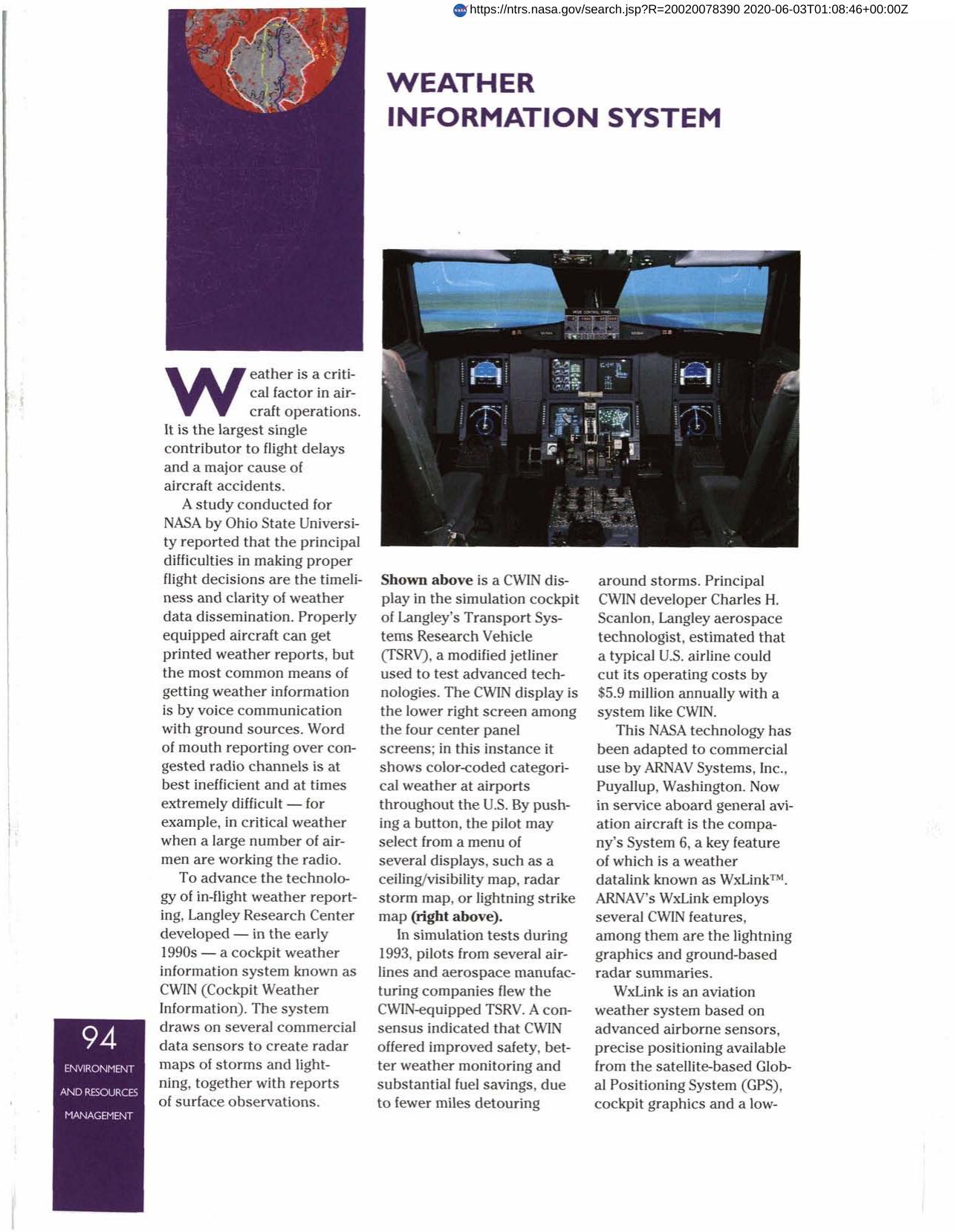

Weather Information System
WxLink is an aviation weather system based on advanced airborne sensors, precise positioning available from the satellite-based Global Positioning System, cockpit graphics and a low-cost datalink. It is a two-way system that uplinks weather information to the aircraft and downlinks automatic pilot reports of weather conditions aloft. Manufactured by ARNAV Systems, Inc., the original technology came from Langley Research Center's cockpit weather information system, CWIN (Cockpit Weather INformation). The system creates radar maps of storms, lightning and reports of surface observations, offering improved safety, better weather monitoring and substantial fuel savings.
Full article: http://hdl.handle.net/hdl:2060/20020078390
Weather Information System
Weather Information System


