
Aqua Solutions for Terra Firma
Subheadline
NASA satellite imagery supports weather app for farmers in drought-stricken regions of India
Increasingly unpredictable monsoon seasons in India are playing havoc with small farms, to the point that, according to India’s National Crime Records Bureau, thousands of the country’s farmers commit suicide every year, a crisis that troubled Pankaj Patil.
As someone who grew up in a rural area of the South Asian nation, Patil knew farmland was prone to droughts, and that problem was only getting worse with climate change. These areas were not well served by ground-based weather forecasting technologies like Doppler radar. Having worked with NASA as a graduate student in Florida, he knew the instruments aboard the agency’s Aqua and Terra satellites could help.
First launched in 1999 and operated out of NASA’s Goddard Space Flight Center in Greenbelt, Maryland, the Moderate Resolution Imaging Spectroradiometer (MODIS) instruments aboard Aqua and Terra produce tremendous amounts of weather data. Using several wavelengths of visible and infrared light to image the entire surface of Earth every one to two days, the satellites paint a detailed picture of our home planet. This includes water levels, vegetation health, and events like volcanic eruptions, heatwaves, and fires.
“MODIS has numerous products that are used by scientists for research in a variety of disciplines, such as oceanography, ecology, and atmospheric science. This technology is incredible and will open new doors for research across the globe,” said Dr. Miguel Román, MODIS science team leader at Leidos, which manages Aqua and Terra for NASA. “It’s like having a Swiss army knife for studying the climate from space.”
Building off his prior experiences making business cases with NASA technology, Patil cofounded ilika Geospatial LLC of Edison, New Jersey, in 2020. The company uses satellite imagery to help various industries around the globe, from banking to agriculture, learn from the data provided by NASA’s Earth Science missions .
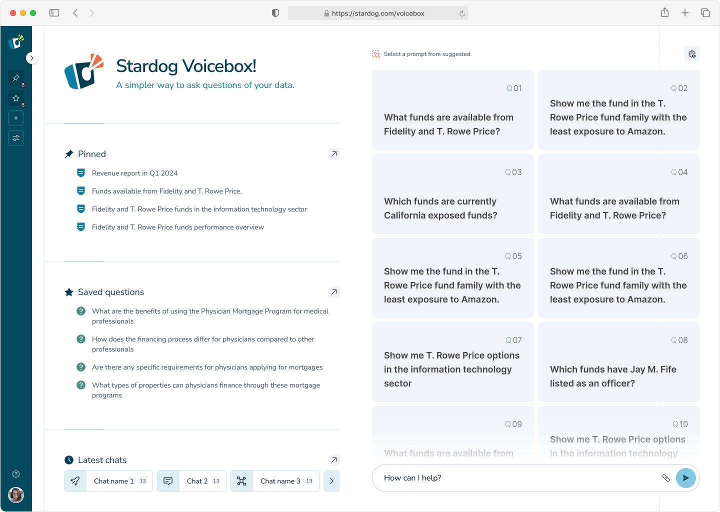
One of the first projects undertaken by the company was an app called Hawamaan, which means “weather” in the Hindi language. The application has a specific focus on South Asia, targeting the underserved farmers Patil knew of. Using data from the MODIS instruments, the app can show the availability of water and rainfall trends in the region, simplified from raw satellite data into easy-to-read graphics.
“We needed to get these images in front of these people in the most convenient way possible,” Patil said. “So why don’t we just write an app that is not only giving the weather forecast, but also giving this additional context where people can look at the numbers?”
Patil says the app is now used by thousands of farmers across the subcontinent. Hawamaan can be downloaded on smartphones and mobile devices that are popular in the region.
While the company started with this app, it is expanding into the larger geospatial intelligence industry. Aqua and Terra are among the data sources included in its Earth Observation Indices program, a curated selection of figures that show the world’s ecosystems and the connections between them. These include not only the availability of water for agricultural use but also indices that reflect atmospheric conditions, the recurrence of wildfires, and more. Patil says that even though the company has expanded its offerings, the Hawamaan app is still a priority and will keep being updated for as long as the company is around.
“It will always be supported,” Patil said. “We can’t forget our roots.”
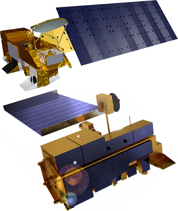
NASA’s Aqua and Terra satellites both feature a scientific instrument called MODIS that takes extremely detailed images of Earth’s environment. MODIS data is a key part of ilika Geospatial’s offerings, as it provides enormous amounts of information relevant to people on the ground, from farmers to CEOs. Credit: NASA
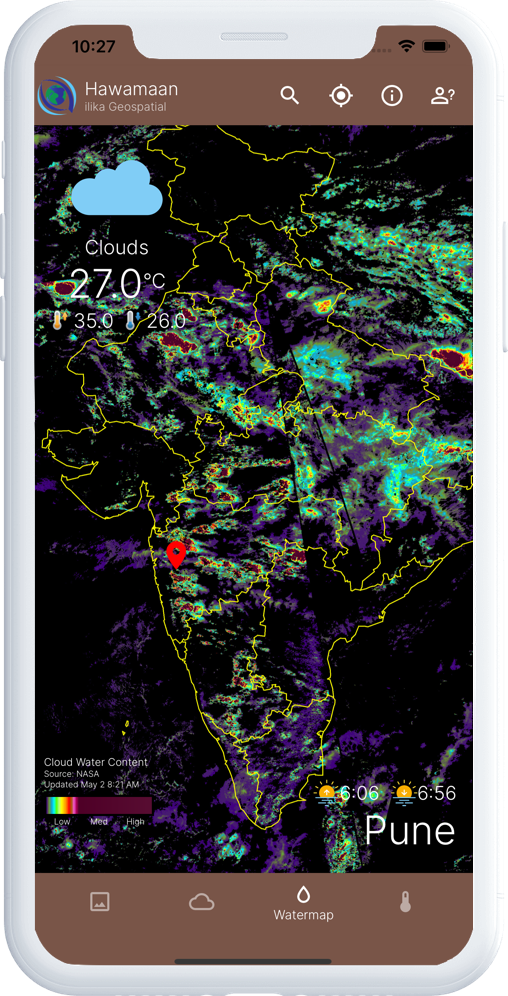
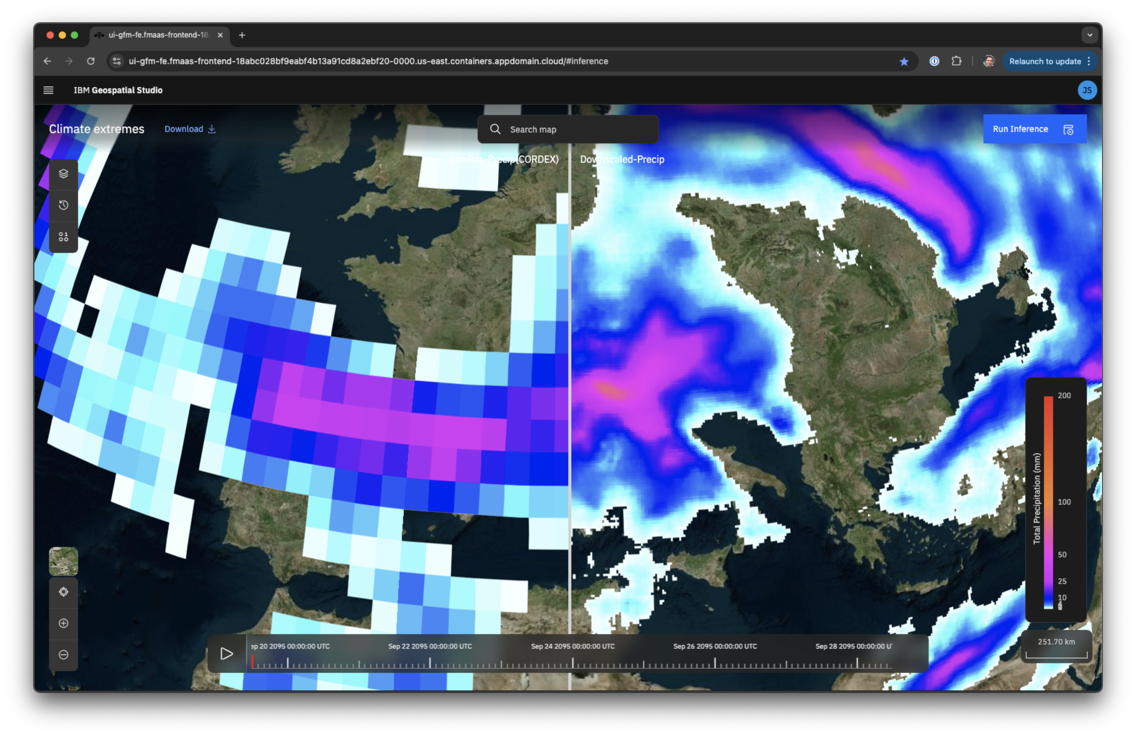
This screenshot of the Hawamaan app shows numerous weather systems over India. Data from the orbiting MODIS instruments allows the app to display forecasts for areas that don’t have access to ground-based solutions like Doppler radar. Credit: ilika Geospatial LLC
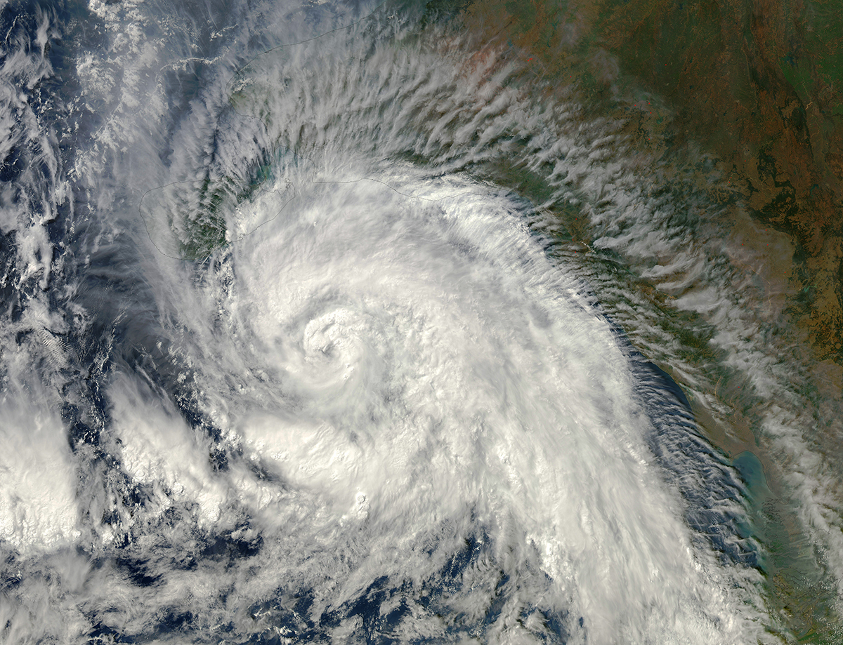
Tropical Cyclone Madi approaches India in 2013, as seen from the Moderate Resolution Imaging Spectroradiometer (MODIS) instrument aboard the Aqua spacecraft. Because the satellite’s imaging capabilities have a global reach, ilika Geospatial uses data from Aqua and its sister satellite Terra to provide weather forecasting in underserved areas of India. Credit: NASA/GSFC/Jeff Schmaltz/MODIS Land Rapid Response Team